Behold Great Smoky Mountains National Park: straddling North Carolina and Tennessee, it’s the most-visited NP in the United States! Normally, if something is “most visited >>whatever<<“, we’re running far and fast … like a bear is chasing us … to get away!
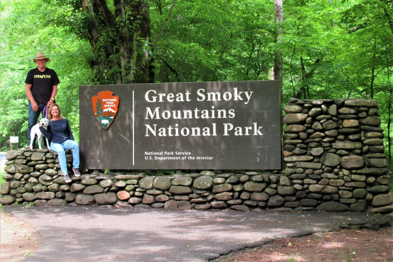
But, with many plans having been cancelled due to Covid, this summer found GSMNP to be blessedly open and available, with few of the crushing crowds one might normally expect. Ahhhh!
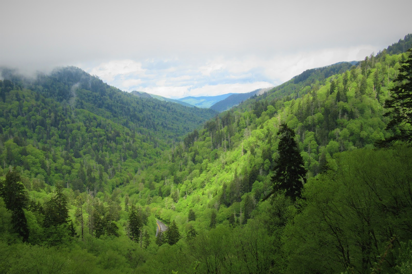
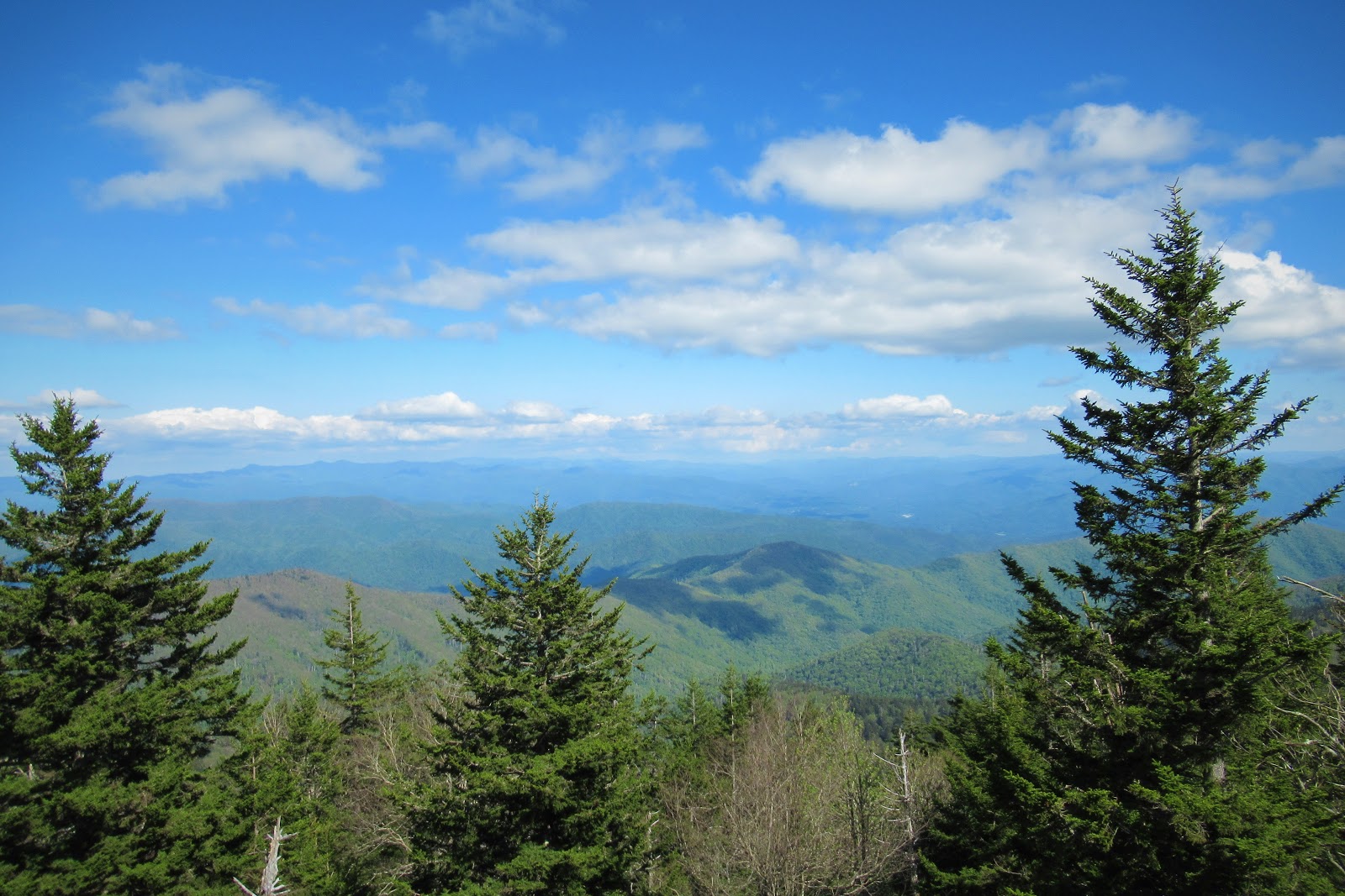
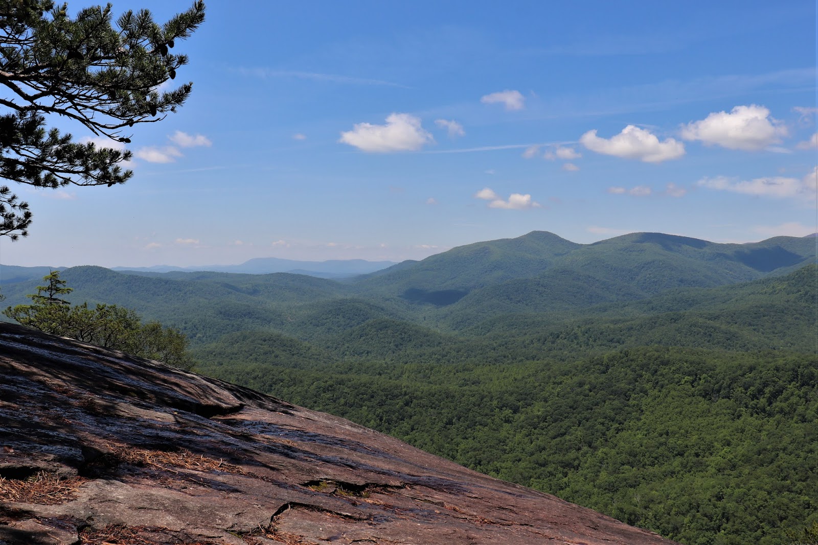
GSMNP is only a day’s drive from 1/4 of the entire U.S. population, but as there are no gates nor entry fees, one wonders how they could know they are the most visited, but I digress. With long-range views like this, who could blame the hordes for wanting to come?
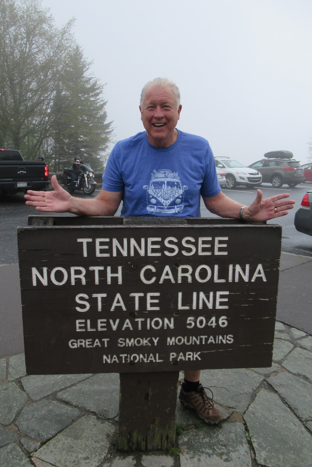
The North Carolina/Tennessee state line splits the park down the middle. Indeed, at the dedication, the always-fair Franklin D. Roosevelt wisely placed one foot in NC and one foot in Tennessee.
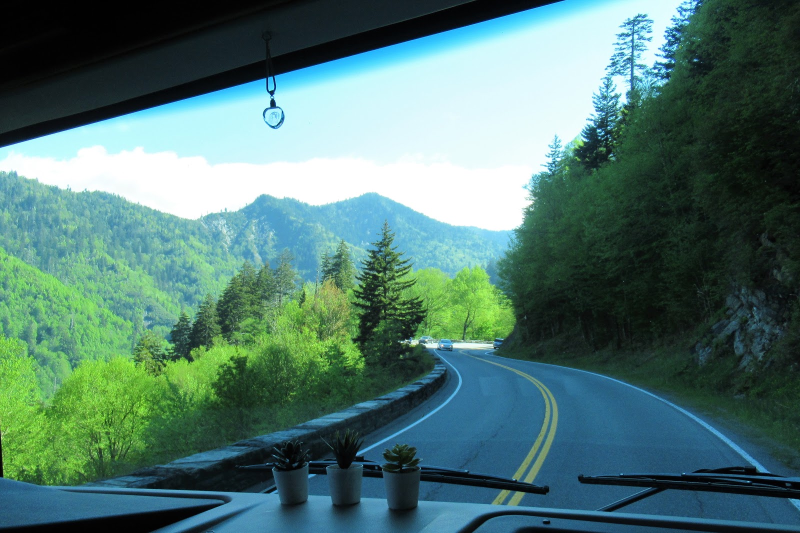
There are two main entrances, one from the North Carolina side at Cherokee, and one from the Tennessee side at Gatlinburg. The wisp of road in the lower left of this photo is the main 33-mile Newfound Gap Parkway between these two cities. Most of GSMNP was logged before it became protected, so all of the trees you see now are actually second-growth.
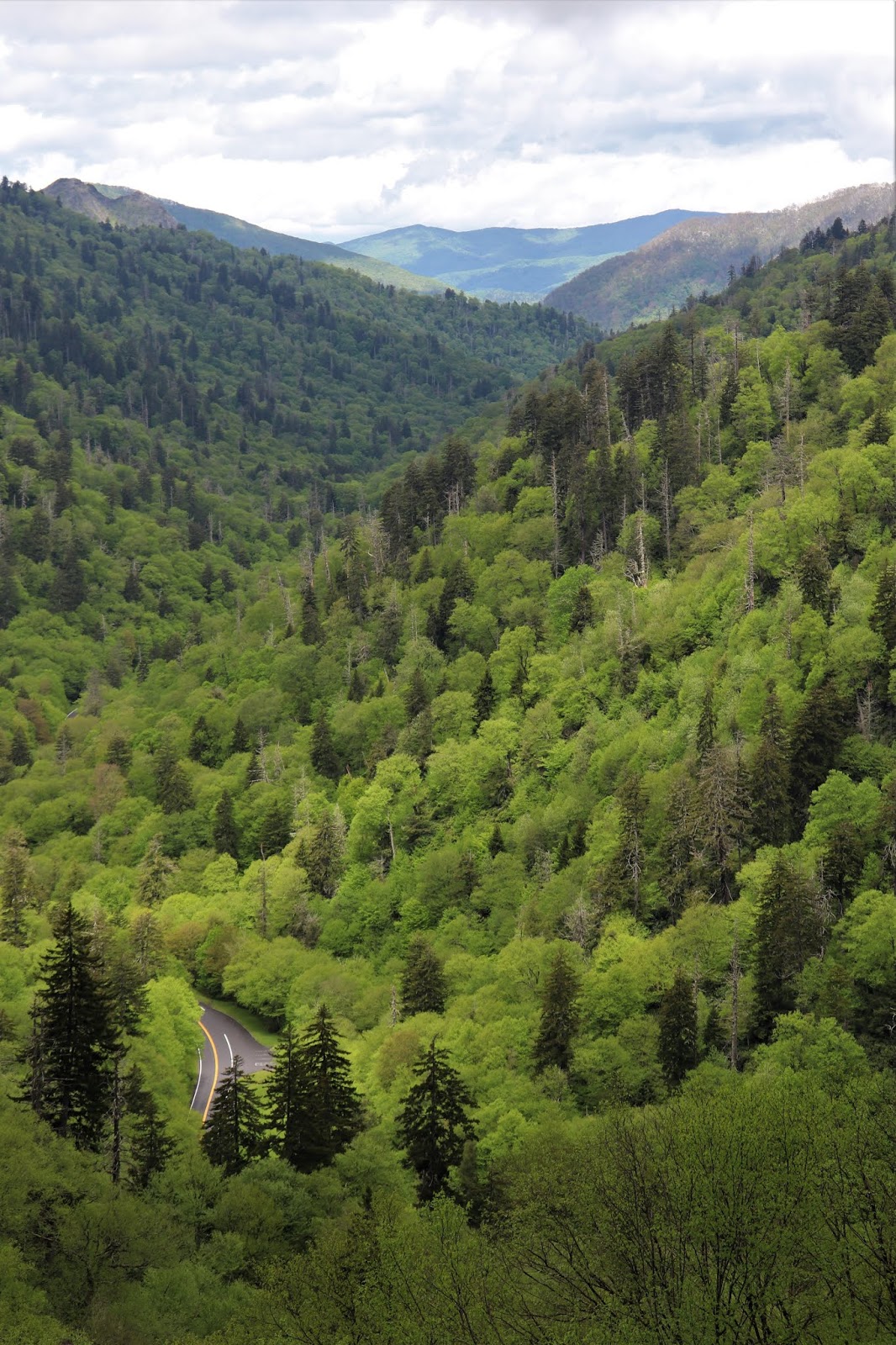
When driving Newfound Gap, you will climb over a mountain pass and back down again, with elevation varying from 875 to 6,643 in the highest reaches of the park. Though twisty and single-lane and with two tunnels, this still a doable drive even for a beastly RV like Elsie, offering scenic views galore out her windshield.
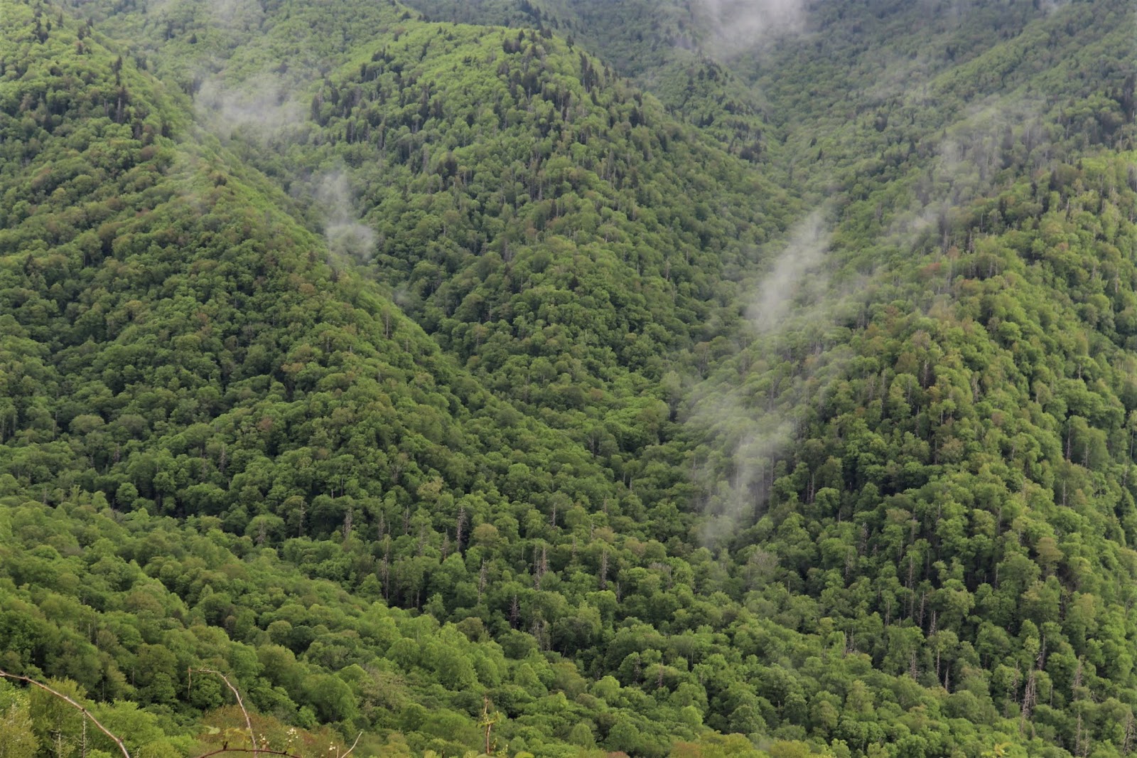
Why are they called the Great Smokies? Cherokee described these mountains as shaconage, meaning “blue, like smoke,” hence the name. The thick vapor hanging in the air is emitted by the surrounding trees, and with 95% of the park being forested, it looks like woodland critters are sending smoke signals to each other!
The park has many preserved historic structures. When restoring these buildings, the National Park Service uses only period-appropriate hand tools, eschewing power tools in order to maintain authenticity.
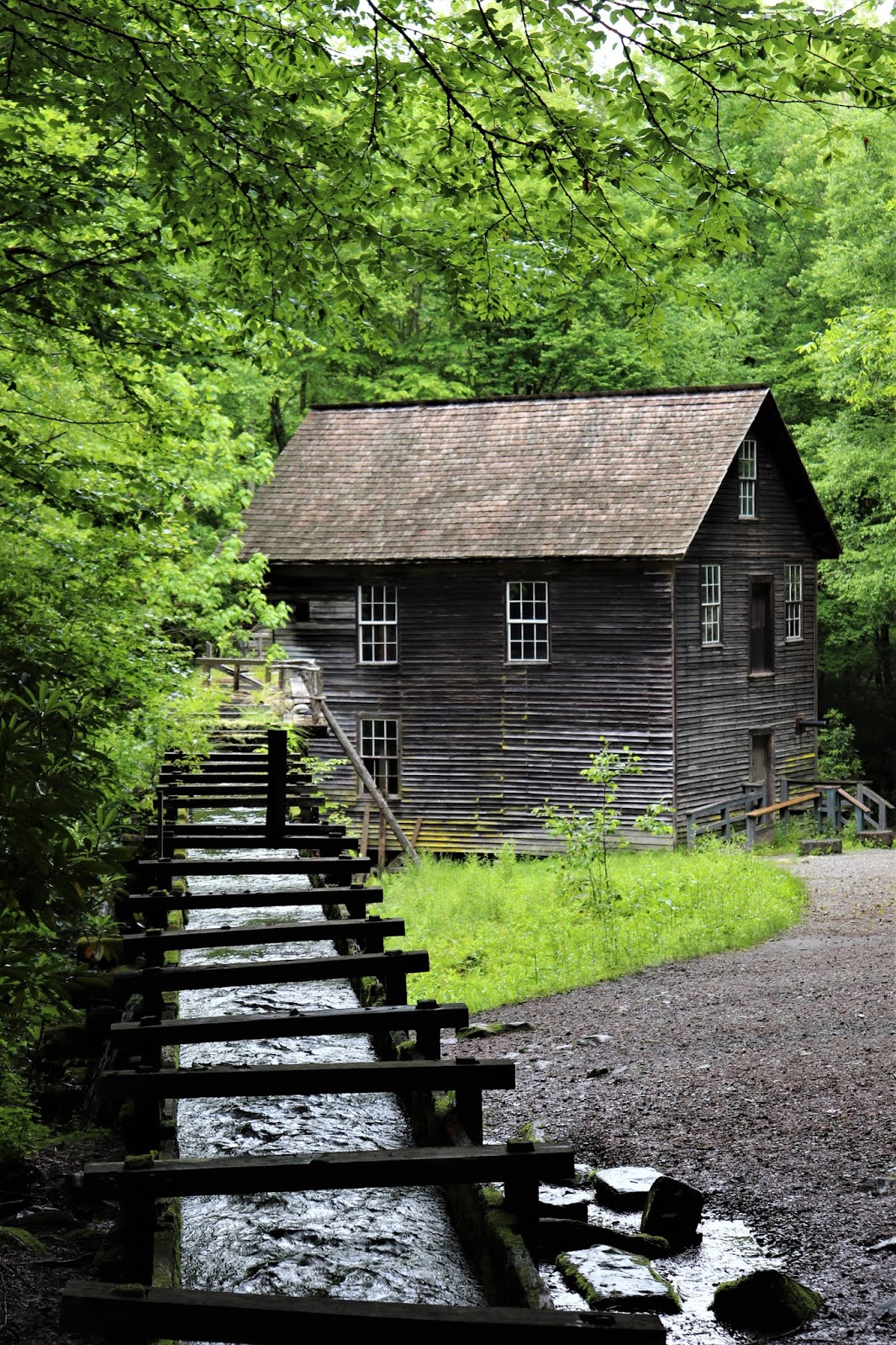
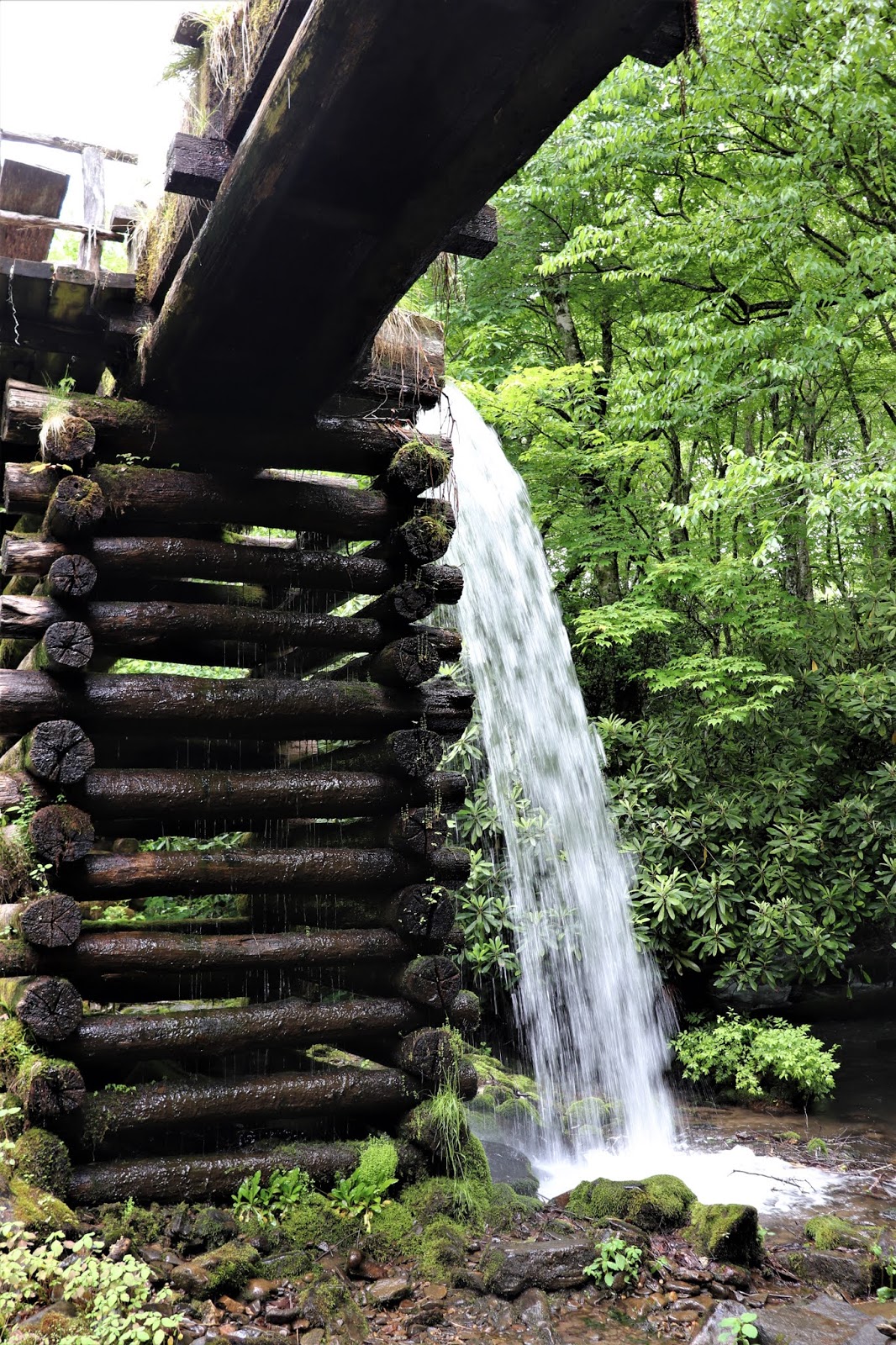
The 1886 Mingus Mill is a water-turbine-powered grist mill, and here they still grind corn into a flour they will sell you.
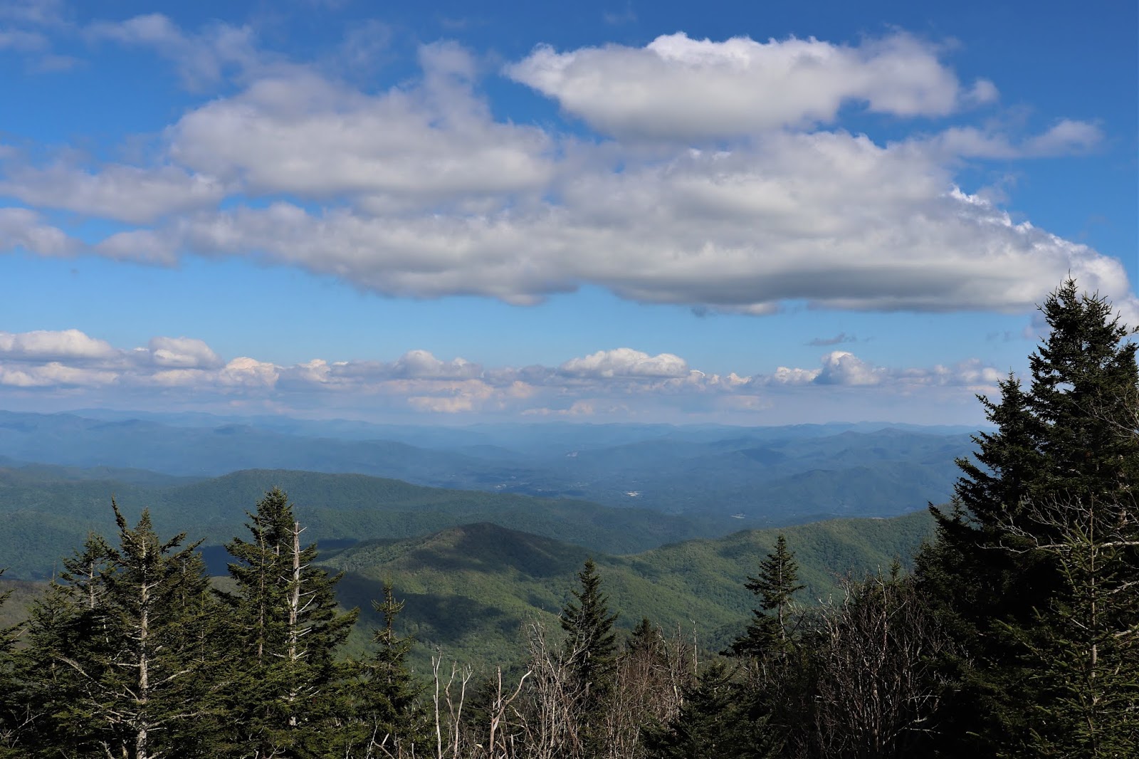
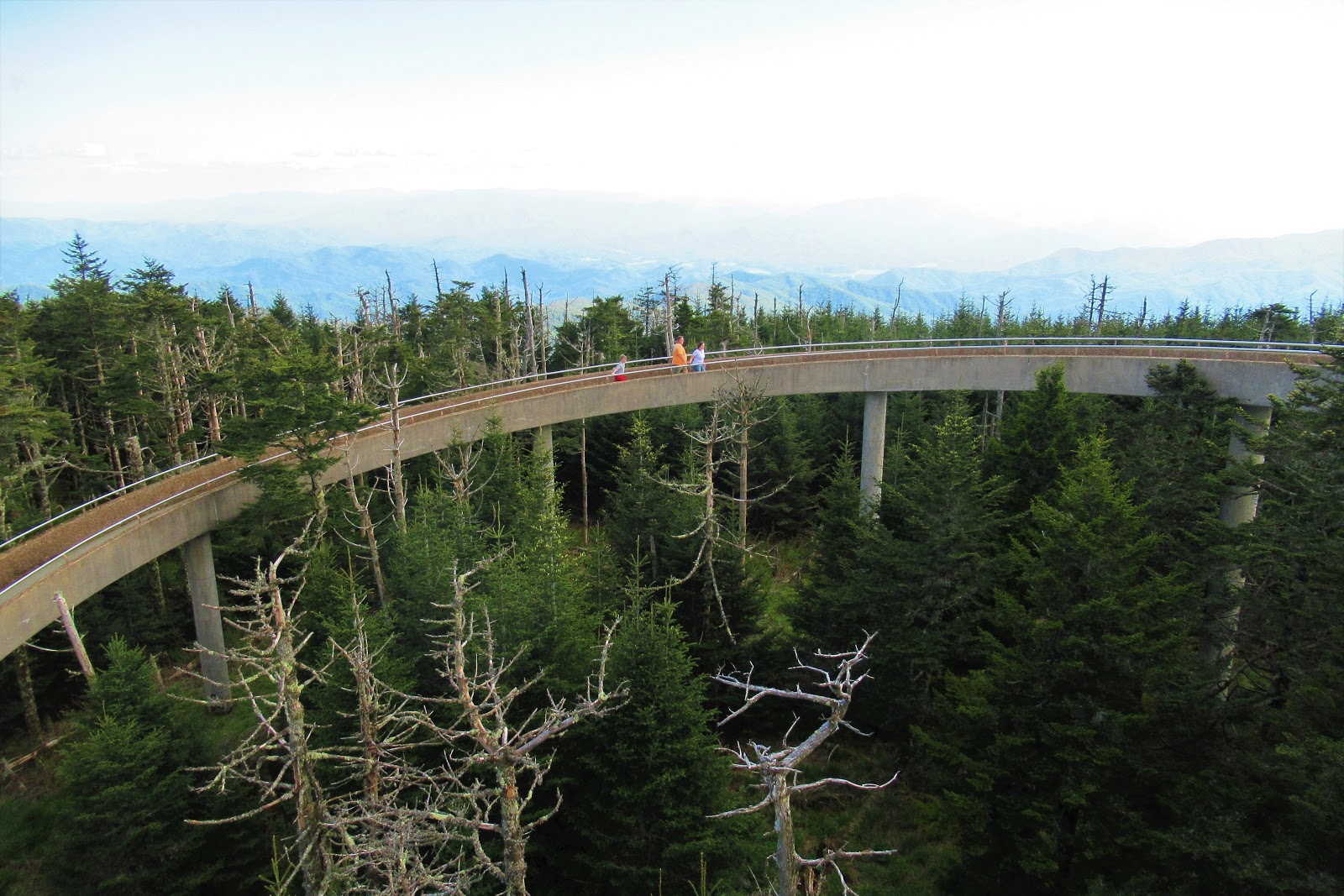
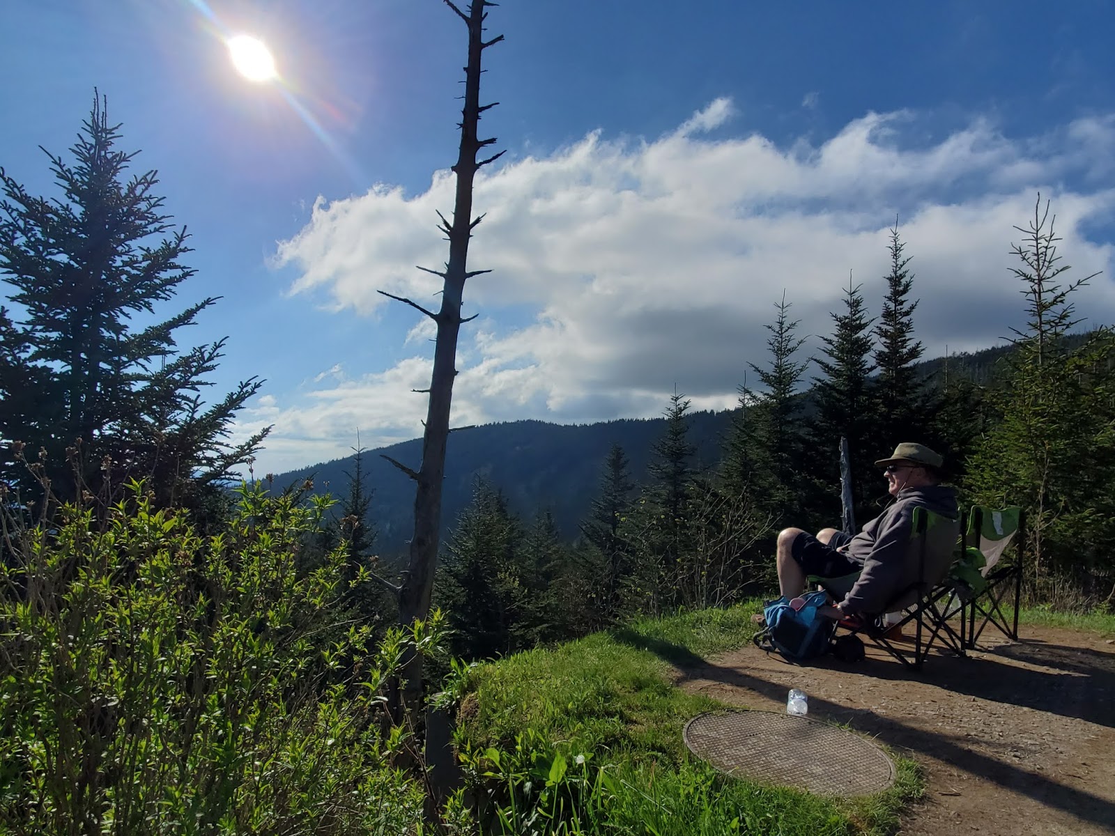
One of the most popular destinations is Clingmans Dome. The park’s highest point at 6643 feet elevation, it is frequently fogged in but if not, you will enjoy some seriously amazing views.
But first, you’ve got a seriously steep (but short!) trail leading to the viewing structure, including a long curved ramp to the top.
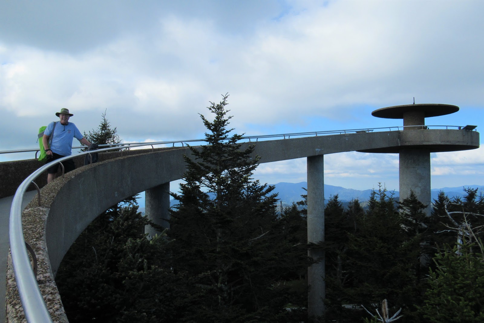
Many people just scurry up the verrrrry steep 1/2 mile path to the top (and then scurry quickly back down when they find out how much colder it is up there), but we couldn’t resist pausing for the perfect Smoky Mountains happy hour on the side of the path.
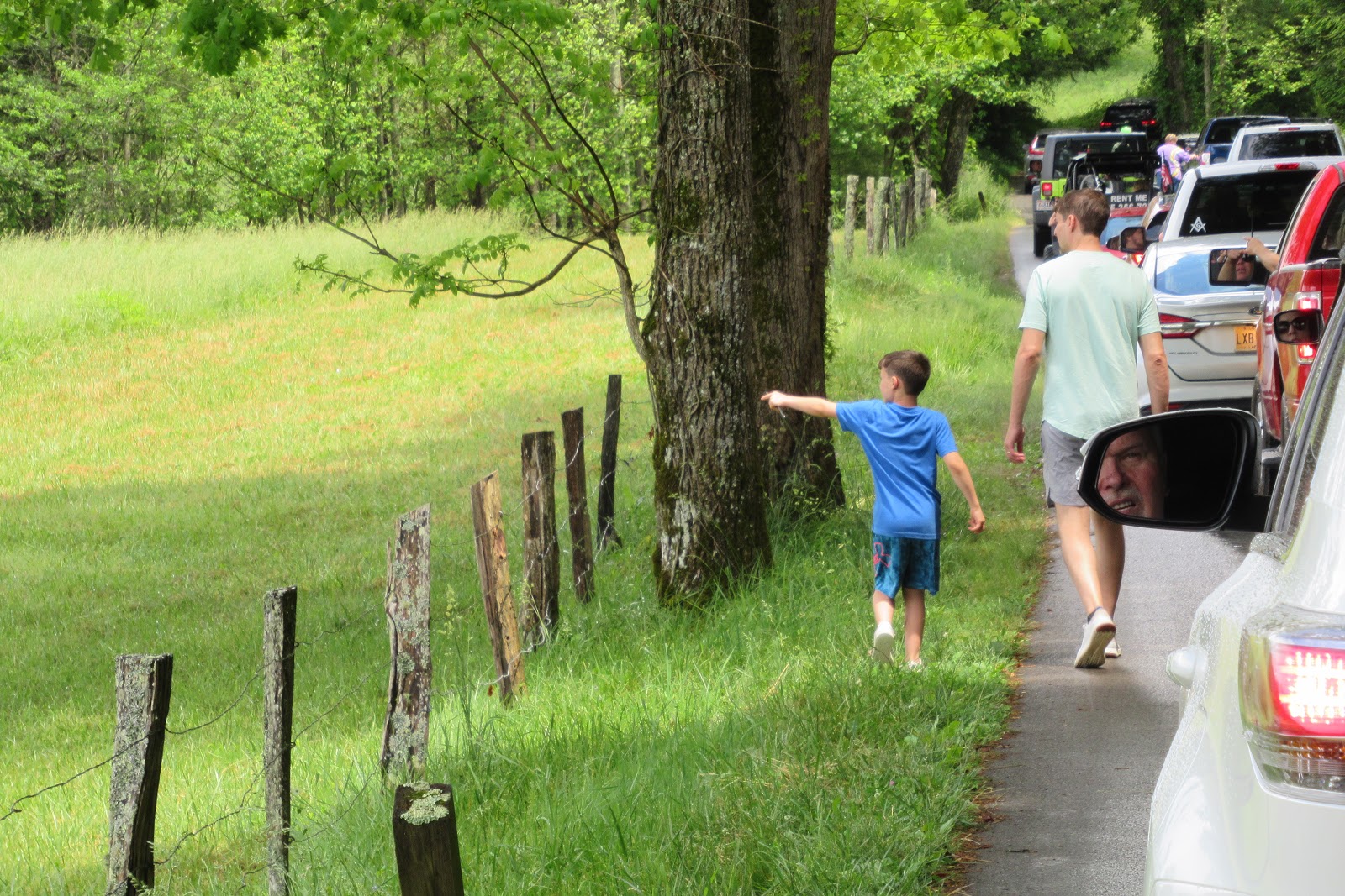
The other “main event” in the park is the Cades Cove Loop Road. Within 10 miles of Cades Cove, a flashing sign indicated “TWO HOURS.” Whaaat? Two hours when it’s that close? Gotta be a typo. But why did that sign just say, “In case of delays, turn off your engine and relax a while”?
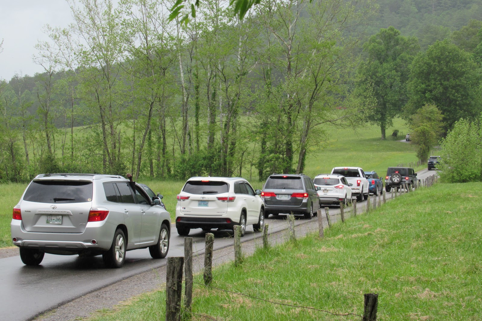
Well, sure enough, it took us 2 hours to get there in 10 miles and drive the 11 mile scenic loop. Why? It’s not a Logjam … it’s a Deerjam, Turkeyjam, or the dreaded Bearjam! With only one lane and no possible alternative exit strategy, you’re at the mercy of every person stopping for everything that moves or breathes.
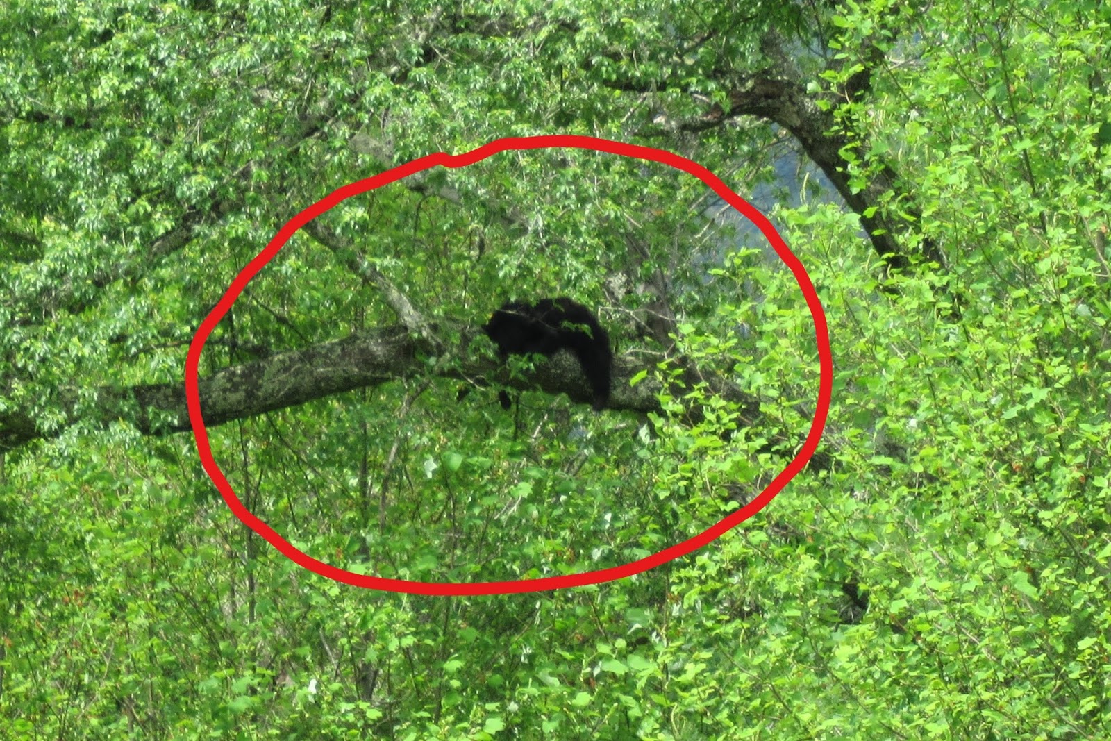
That black blob is a bear. In a tree. Not a sloth. You’ll just have to believe me.
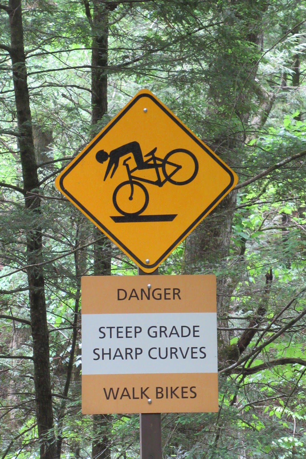
On Wednesdays during the summer, the road is closed to auto traffic and bicyclists have free run of the winding, hilly loop. It seems they have used my likeness on the warning sign without paying me a royalty. That is definitely me on the bike.
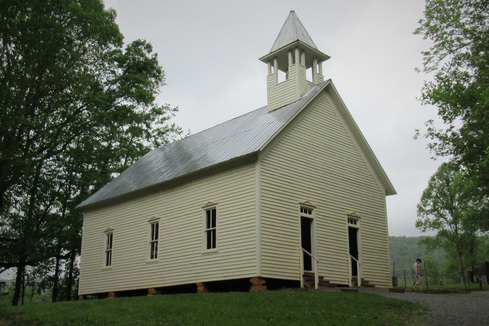
Cades Cove used to be a remote settlement for up to 700 people. Why does this historic church need two doors? One for women to enter, and one for men … wowwwww. Nowadays, there would be 3 doors: Women,
Men, and Gender Non-Declared.
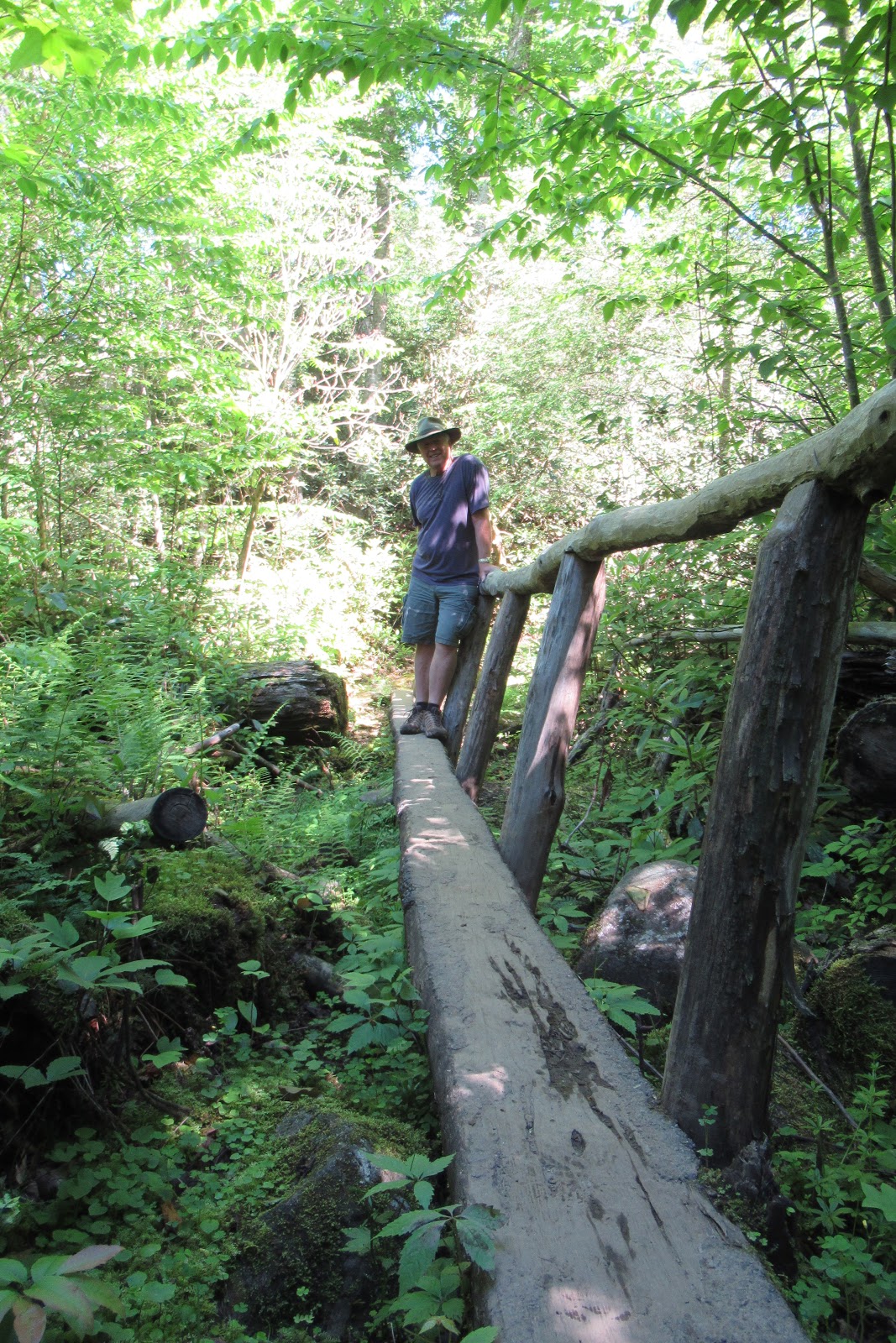
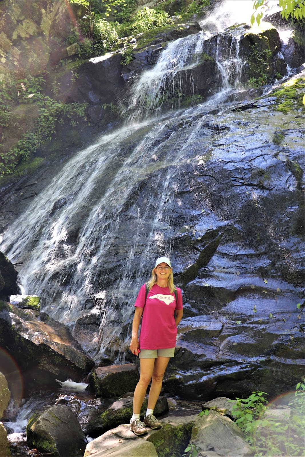
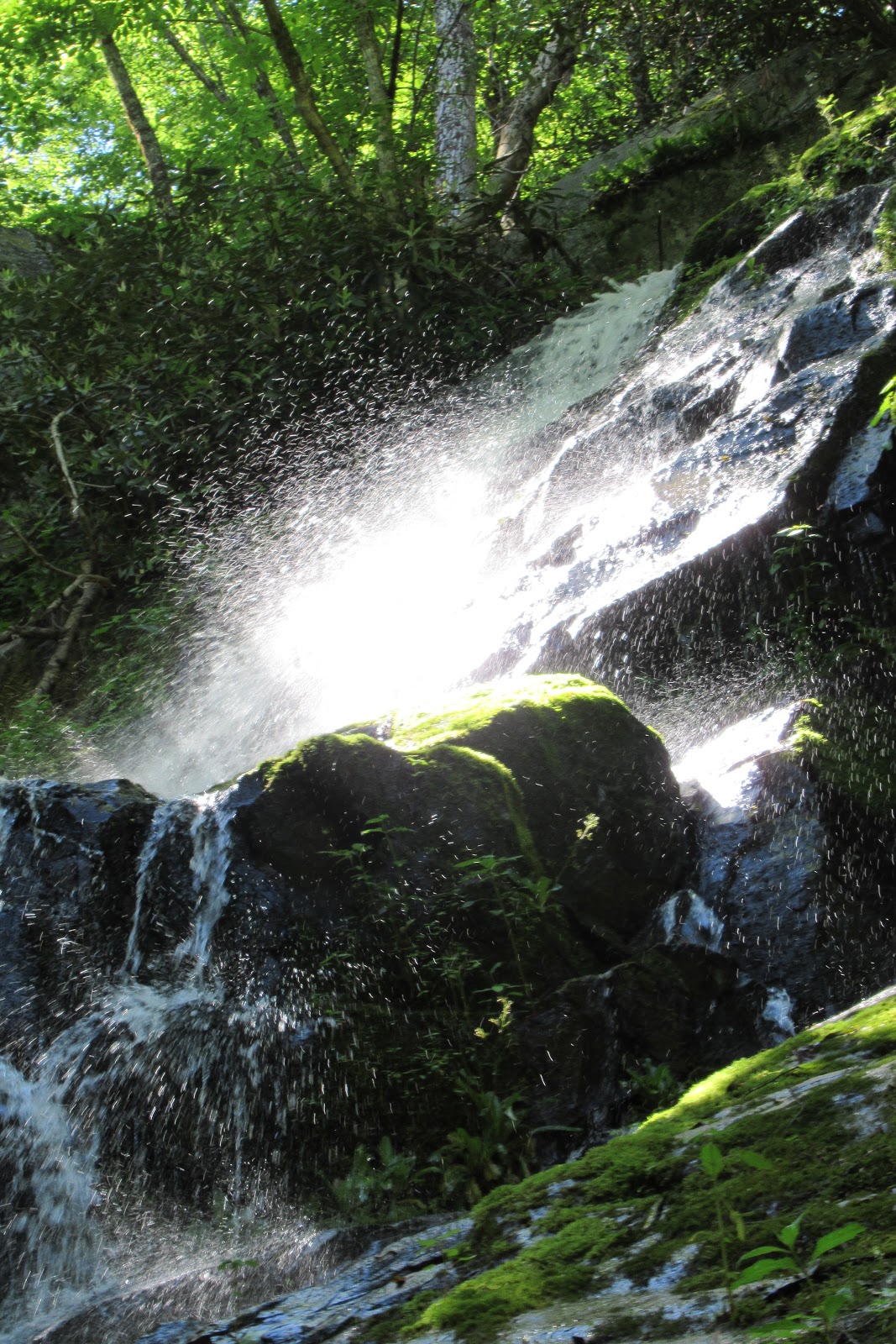
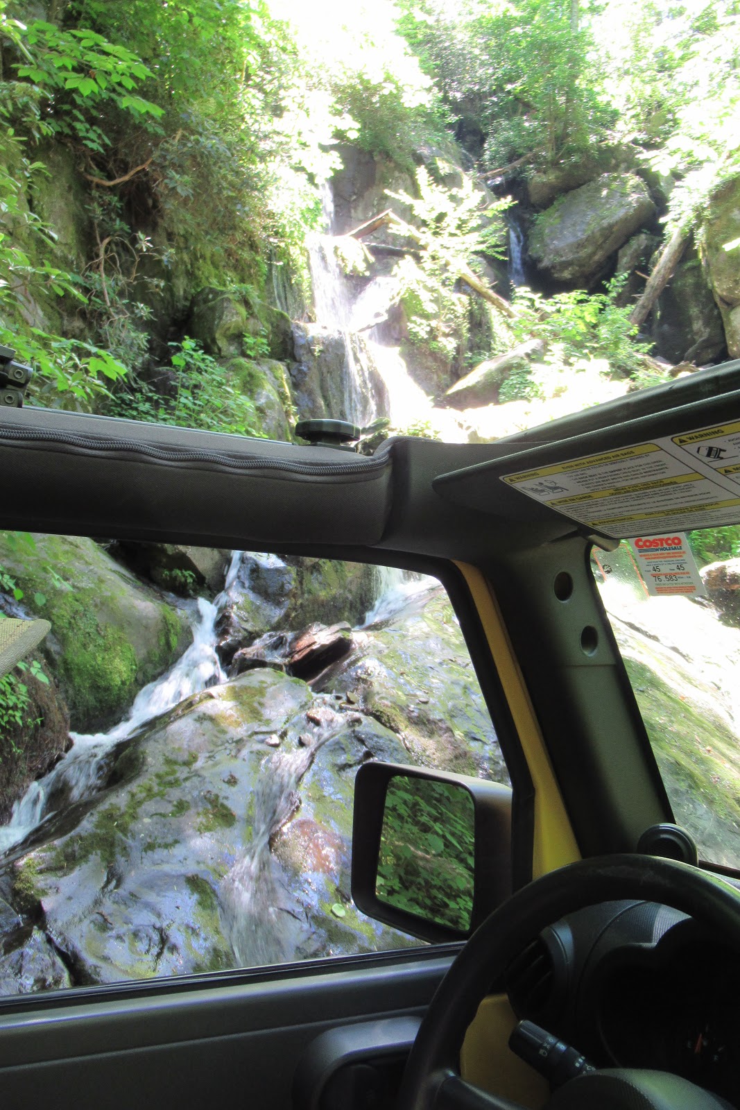
GSMNP has over 800 miles of trails, but popular hikes like Laurel Falls or Alum Cave get all the action, with crowded parking lots, slow-moving clusters of families, and tons of people ruining your Instagram-worthy views. A less populated part of the park on the North Carolina end is the Deep Creek area.
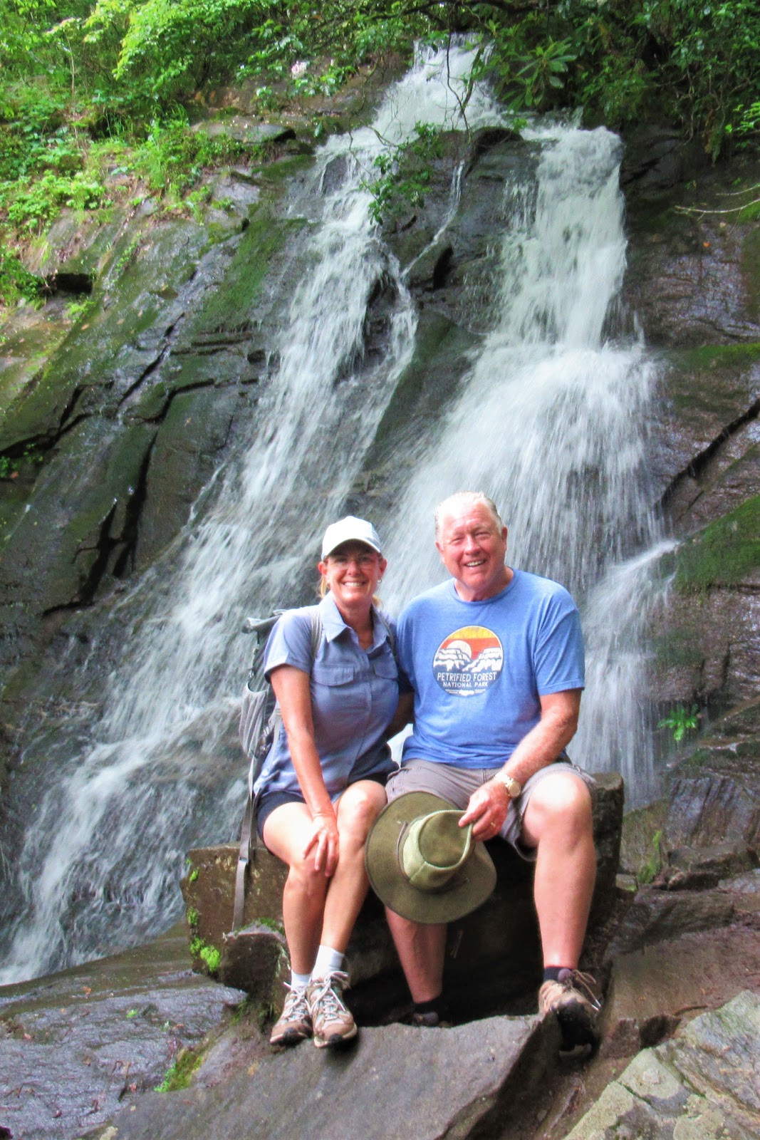
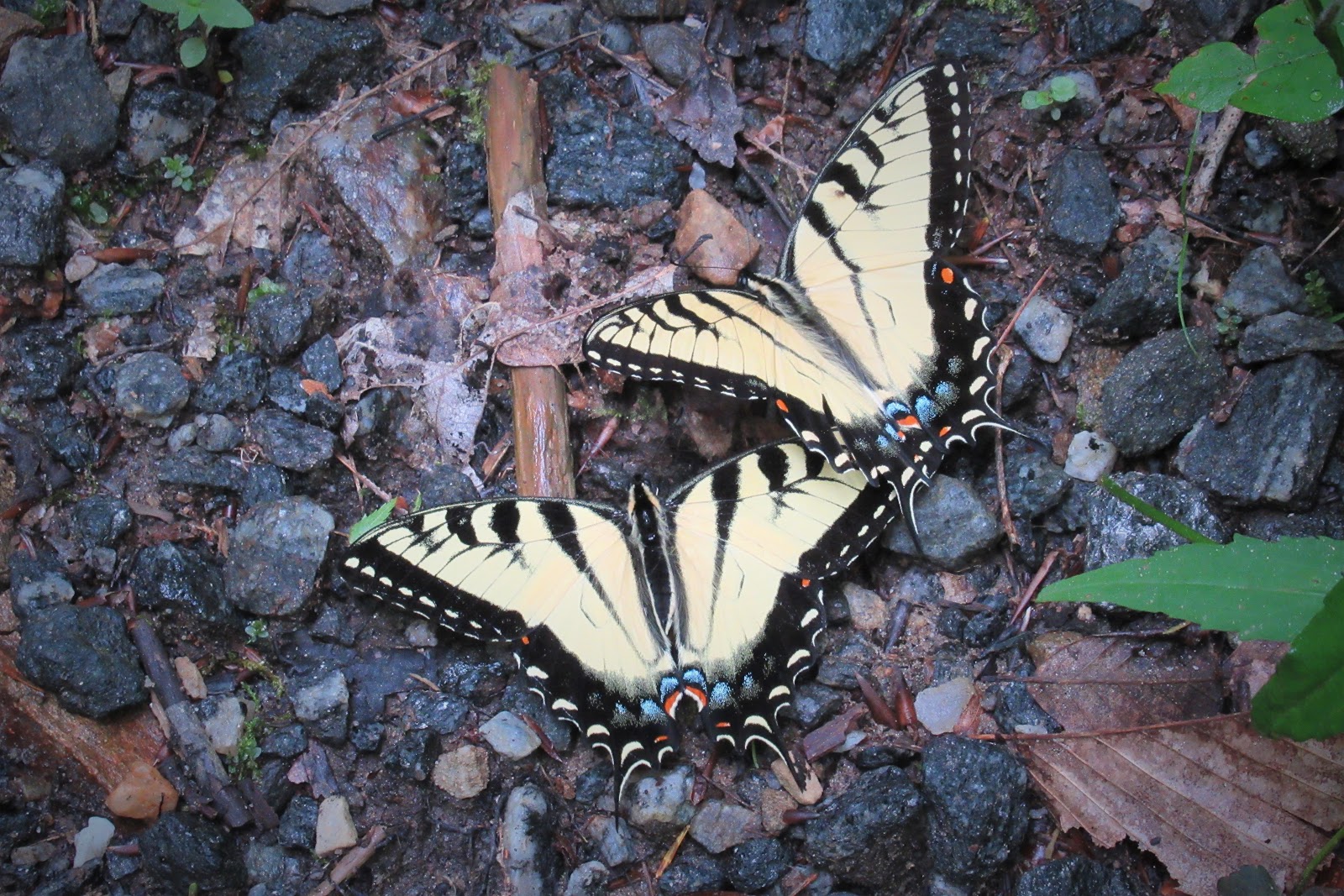
A series of trails leads you to and through various waterfalls like Juney Whank Falls (what a name!) on easy-to-access paths. And … no crowds! The river was babbling, the breeze was blowing, and hundreds of butterflies swirled around as we hiked … Are we in a Disney movie right now?
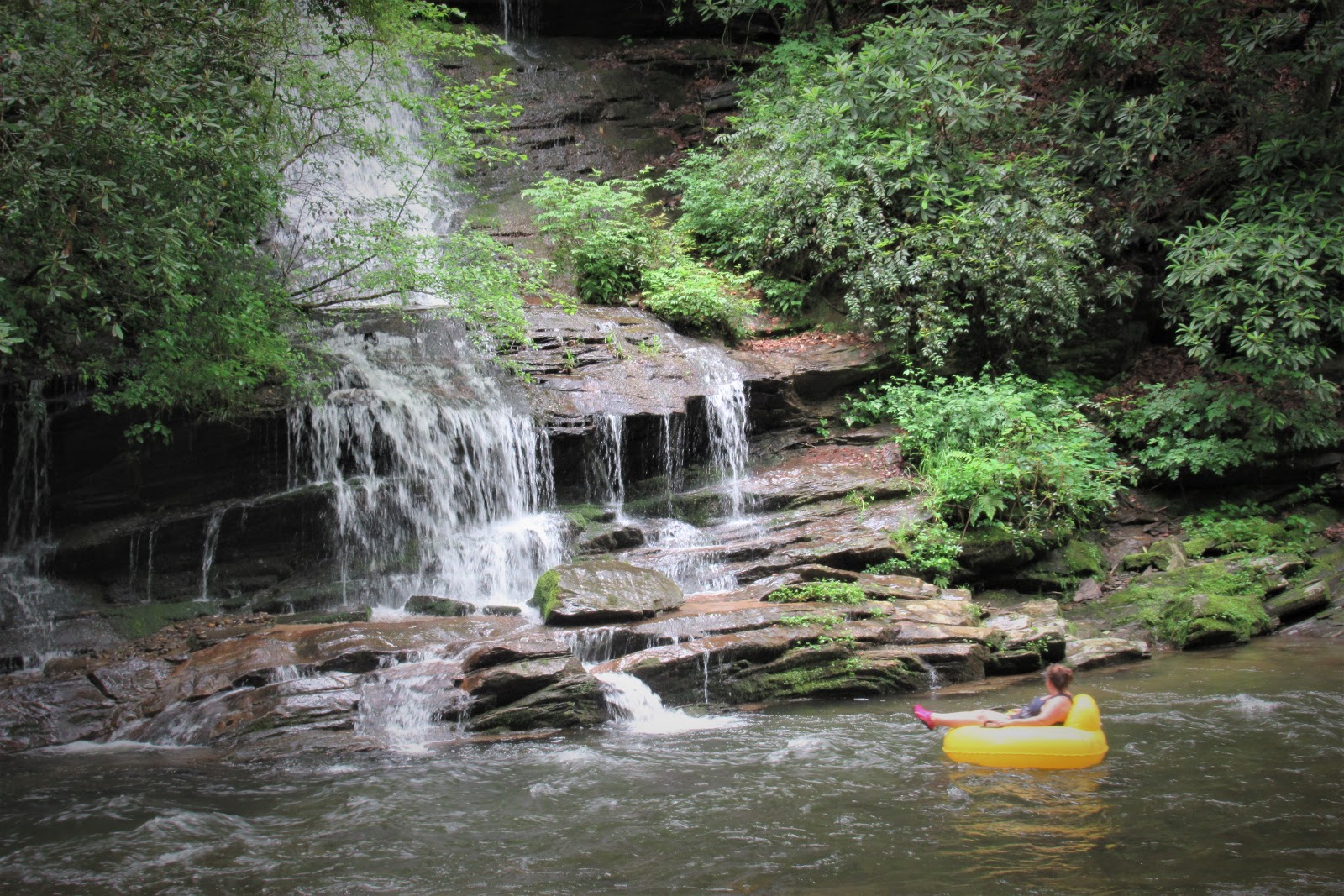
Enterprising roadside entrepreneurs will rent you a tube for $4 for the day. You walk the trail, jump in, ride past scenery like this, and then do it all over again, for as long as you like!
The downside to Great Smoky Mountains National Park (like many others) is that dogs are forbidden from the trails. If you want to include man’s best friend, your best bet on the North Carolina side is the Nantahala Gorge and National Forest.
A portion of the Appalachian Trail that is not only pet-friendly, but also lovely, shaded and completely deserted, leads north from the parking lot at Nantahala Outdoor Center. The A.T. is 2,174 miles long, and 70 steep miles of it goes right through GSMNP.
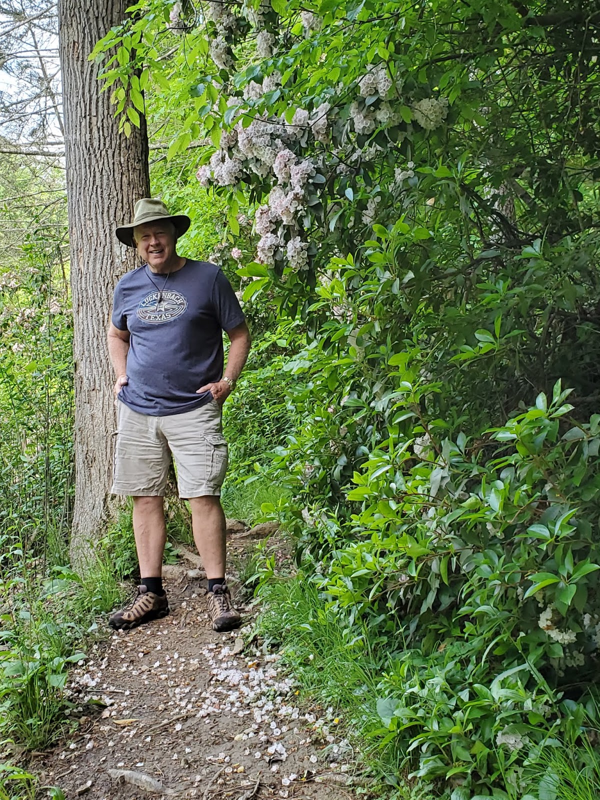
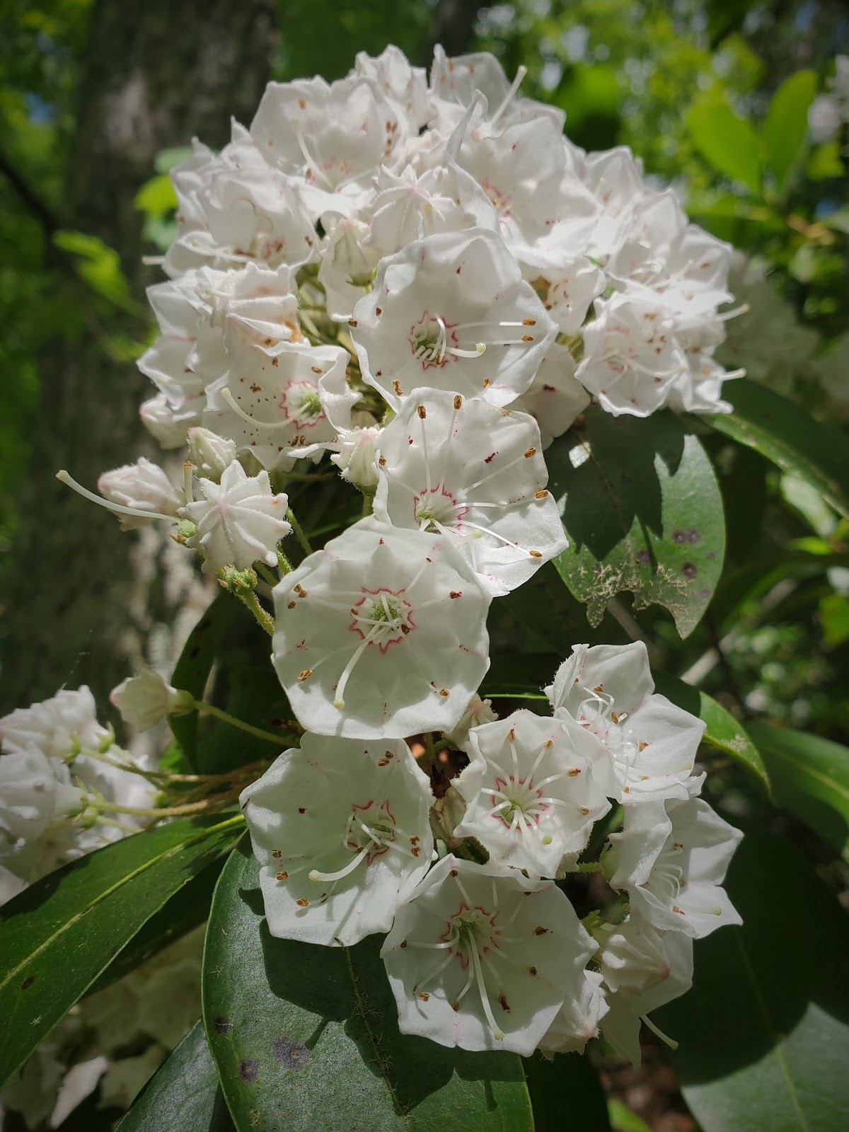
This time of year, many trails are lined with Mountain Laurel. Though pretty, all parts of this plant including its pollen are toxic, and can kill deer, sheep, and humans. Bees even produce poisonous honey from its nectar, and Delaware Indians used it to commit suicide.
On the Tennessee side, the Cosby unit of the park is the least crowded, and the 4.4 mile Hen Wallow Falls trail is superb, with fun (narrow!) creek crossings and a 90-foot waterfall reward at the end.
Though not free, the guides available through the Just Ahead app are an invaluable source of entertainment and information while driving through parks like Big Bend, Yellowstone, and GSMNP. You download the guide into your phone, and it will start and stop automatically based on where you are located, with no cell service required (which is good, because you ain’t gonna have it here). We love these guides and use them wherever available to tell us what it is we are lookin’ at!
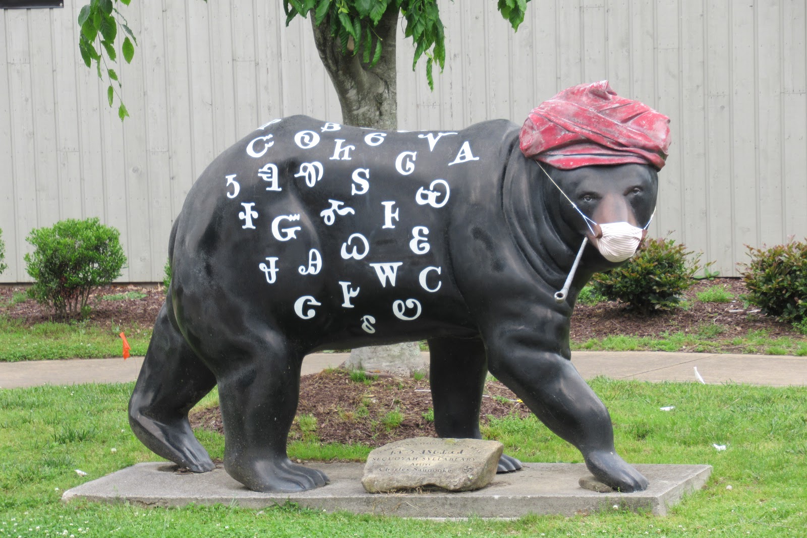
There are no businesses nor commercial enterprises (or even a gas station) anywhere in GSMNP. The town on the two ends of the GSMNP, however, couldn’t be more different from one another. In North Carolina, Cherokee is small, quiet, and bearing tribute to the Eastern band of Cherokee Indians now living on the reservation next to the park.
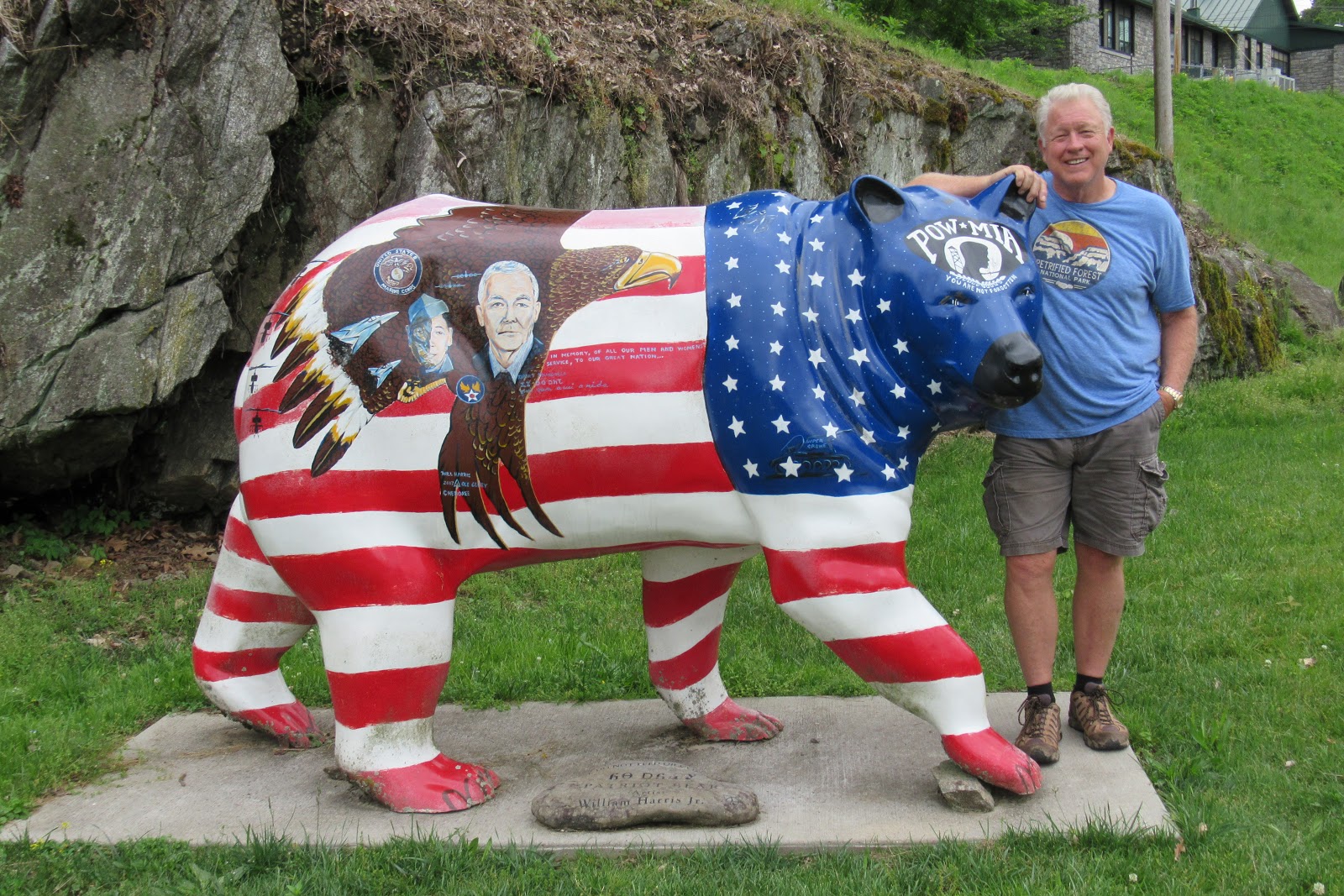
Painted bears are scattered throughout the town like a scavenger hunt (similar to the painted bison throughout Custer, South Dakota), with some of them cautiously donning PPE’s.
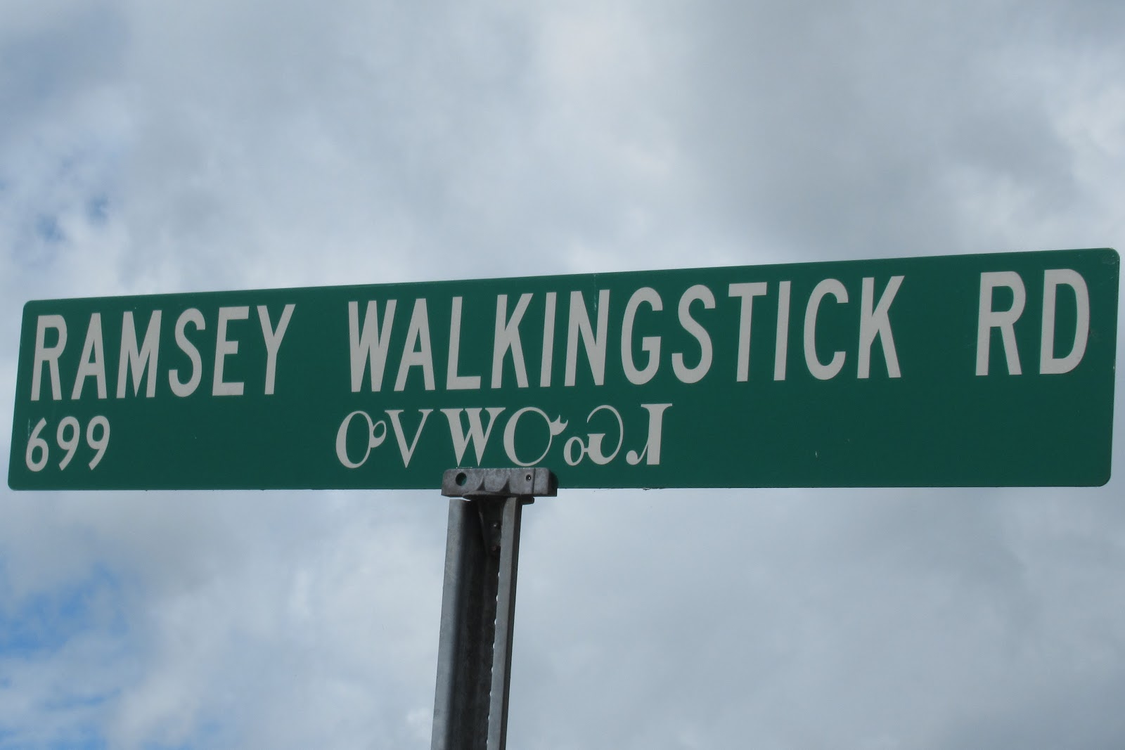
Even the street signs have both English and Indian characters.
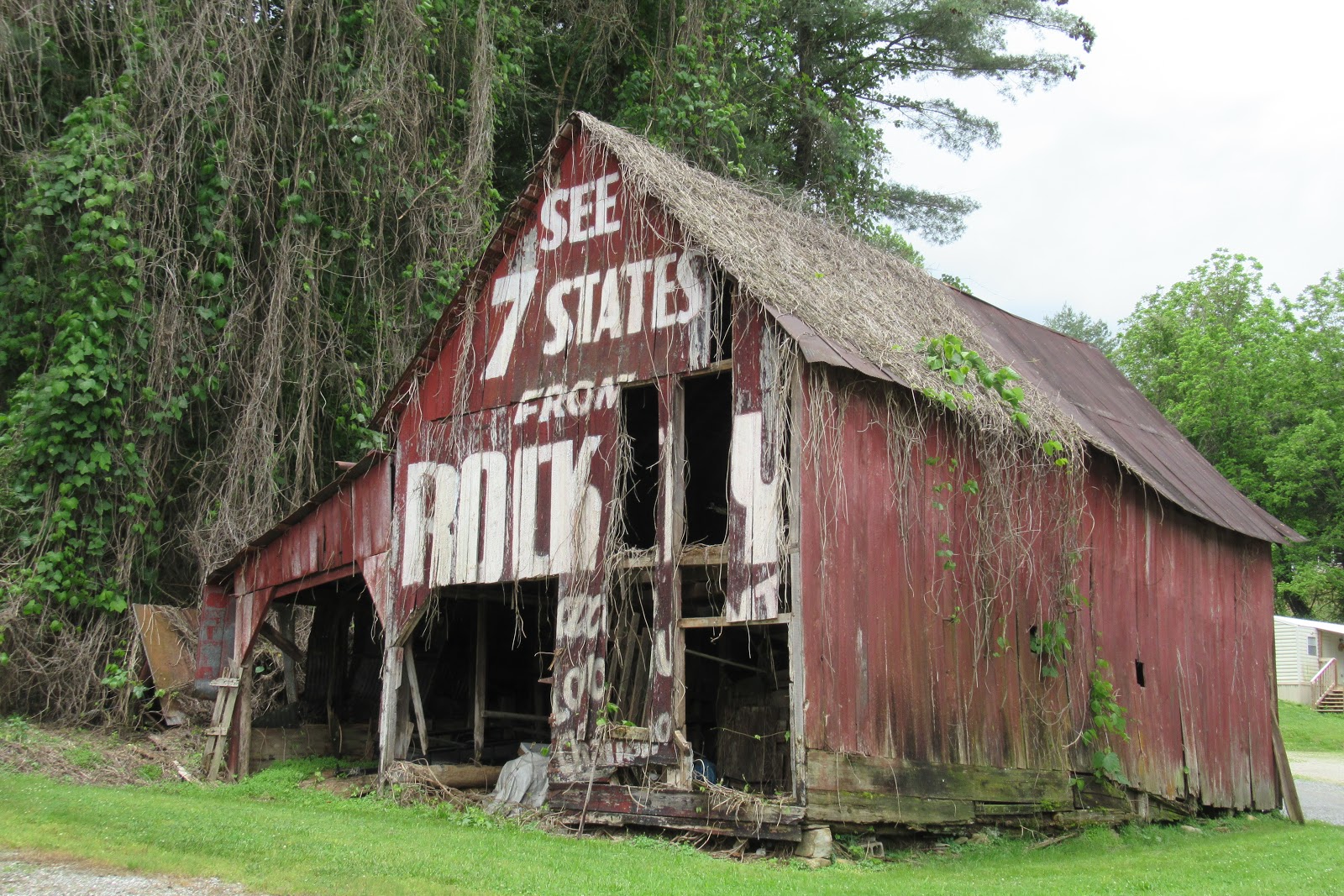
Just down the road from Cherokee, the charming Bryson City is one location of the famous “Rock City barns.” Starting in 1935, a marketing wunderkind named Clark Byers began painting advertisements for Rock City, a little town outside Chattanooga, Tennessee, on the sides of barns throughout the country, eventually painting more than 900 of them, though only 250 remain today. Read more here!
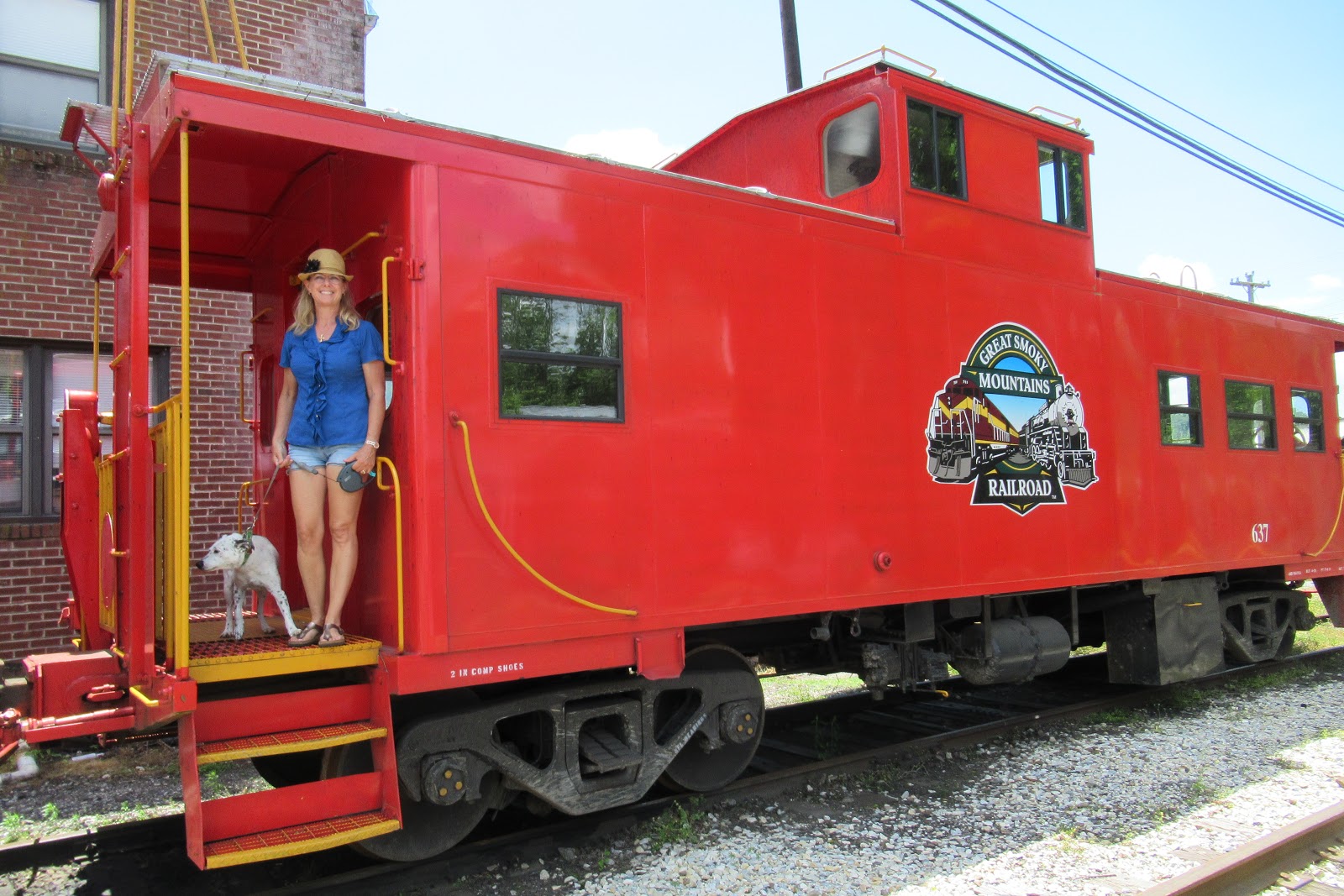
Bryson City is also home to the Great Smoky Mountains Railroad, offering cruises through the Smokies, or special excursions involving vices like beer or barbeque.
Meanwhile, on the Tennessee end of the GSMNP, Gatlinburg is like a family-oriented Las Vegas, with mirror mazes, goony golf, laser tag, 3D movies, Ripley’s Believe It Or Not, magic shows, haunted houses, arcades, t-shirts shops, fudge fudge and more fudge. Dazed tourists stumble around with yard-long plastic cocktail glasses strung around their necks, buying t-shirts and shot glasses and eating greasy carnival food as they go. **this post not endorsed by Gatlinburg Visitor Bureau**
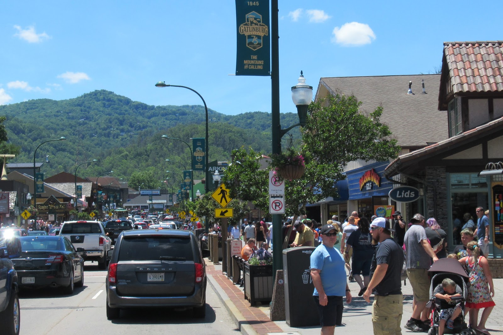
Even though Gatlinburg is literally on GSMNP’s doorstep, clearly nobody in town got the Park Service’s recent memo about social distancing, being crammed together as tightly as sardines throughout the town, with nary a face mask in sight, and nobody seeming to care.
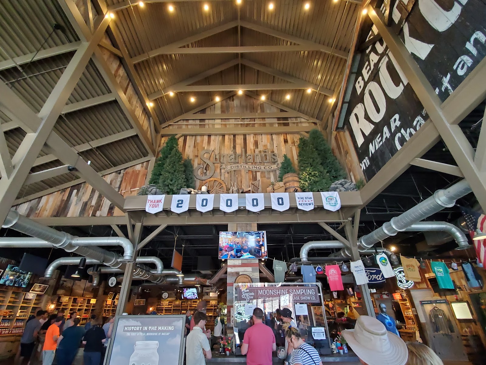
We did brave the Gatlinburg crowds long enough to determine it was not our scene whatsoever, but also to do a little moonshine tasting, because it seems that Tennessee considers moonshine as one of the tiers on the USDA Food Pyramid.
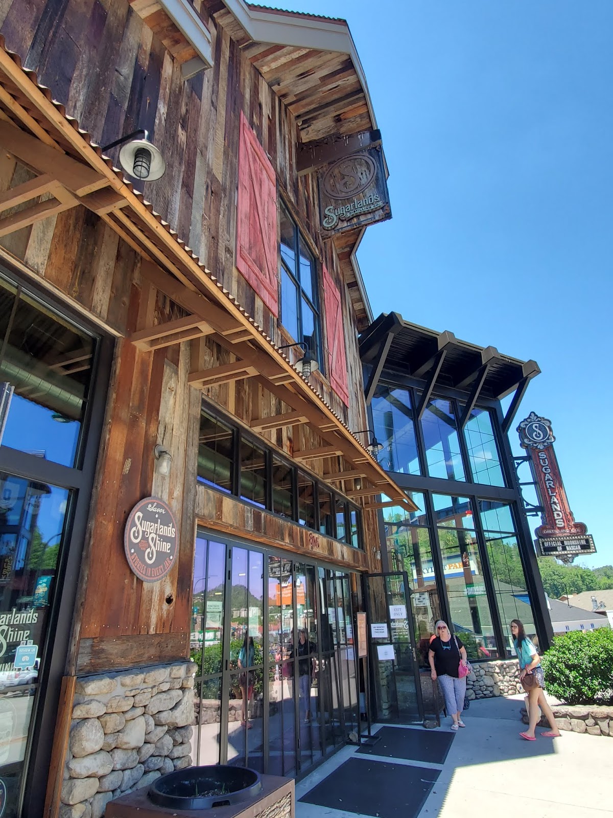
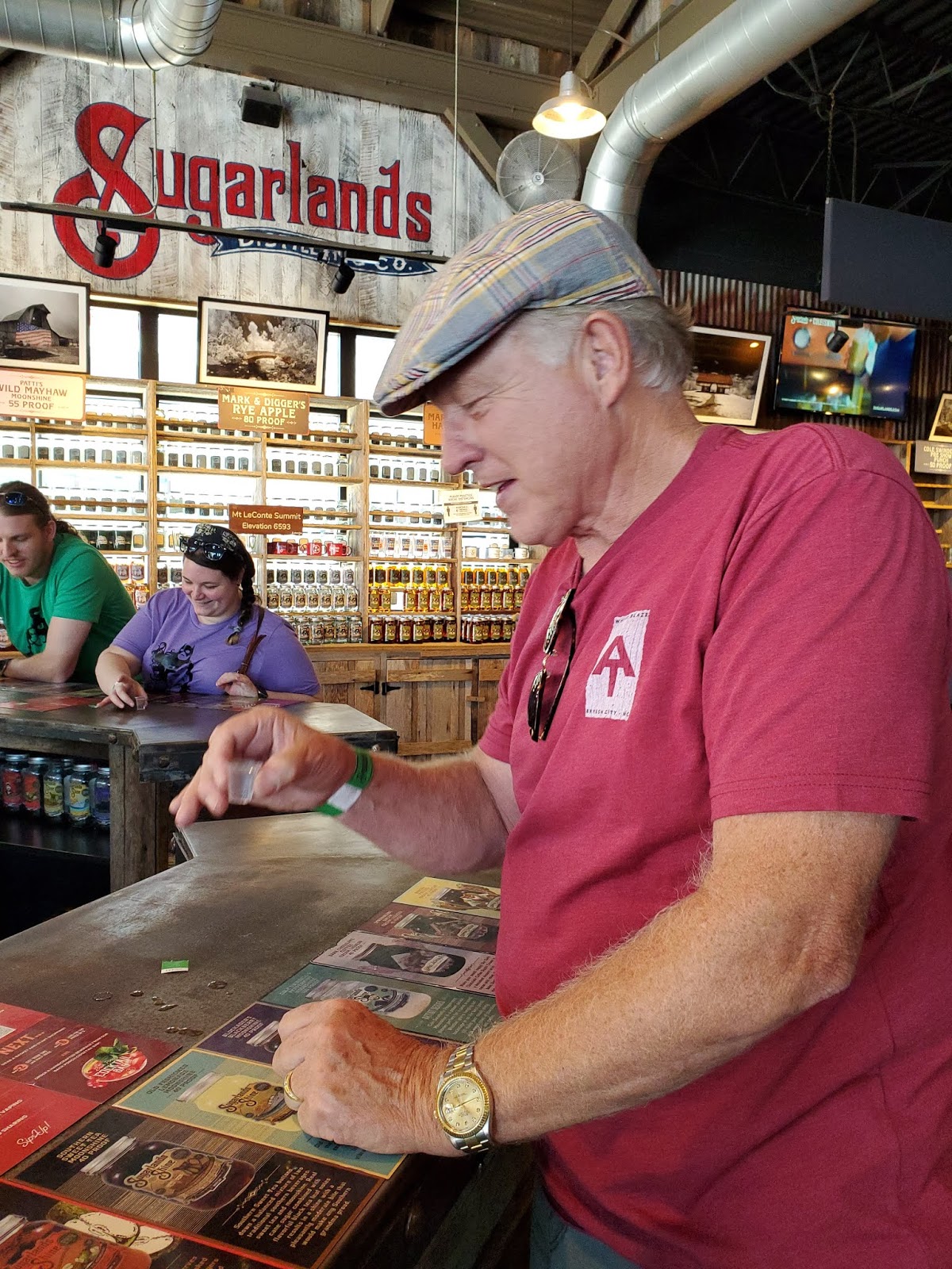
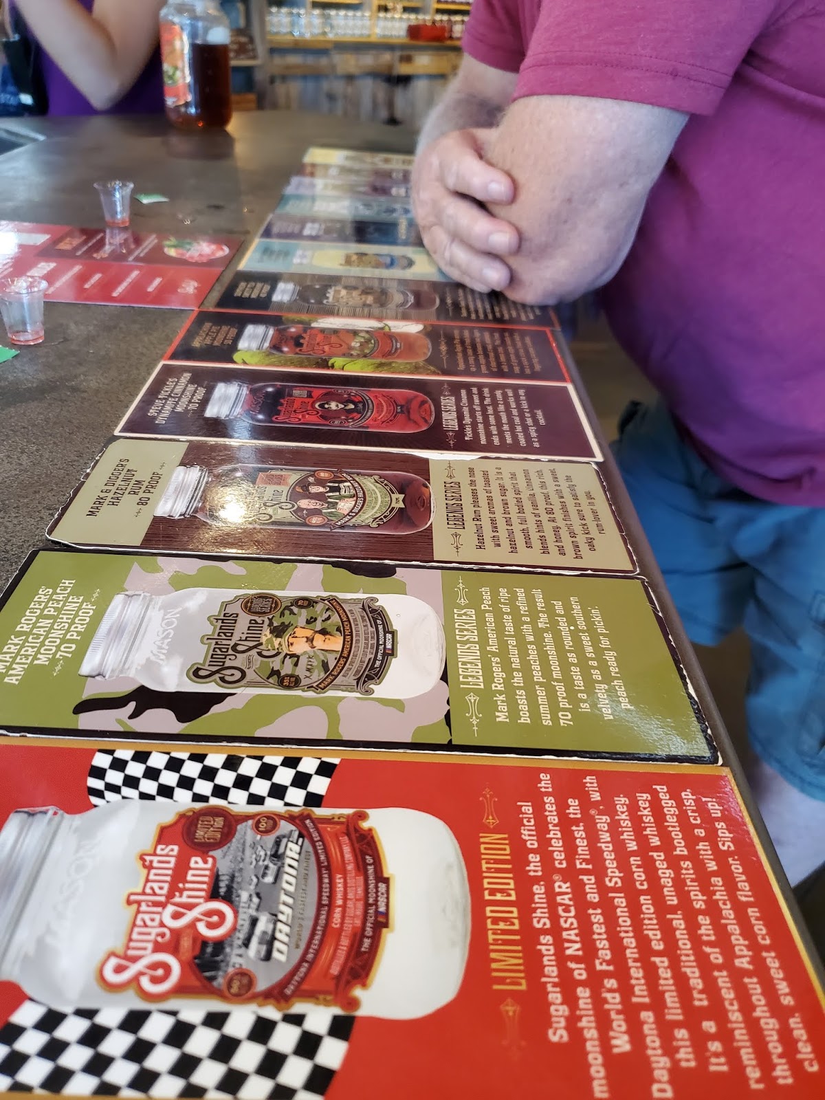
The Sugarlands Distillery has this tasting thing down to a science, and it was a ton of fun and laughter.
Also, we got really plastered. Sure, you’re only getting little communion-sized tasting cups, but you’re getting a LOT of them at a very fast pace! A guide on the countertop in front of you tells what you’re sipping and in what order.
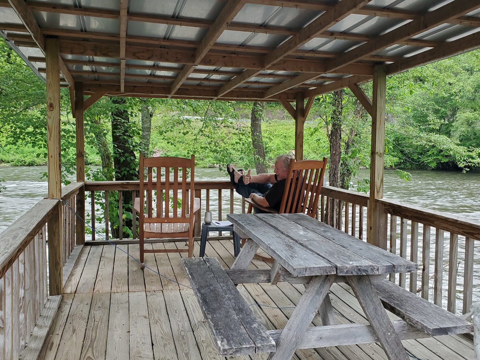
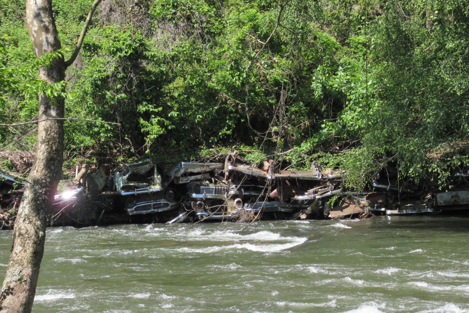
Our two campgrounds in this area were both on rivers, one (Country Girls RV Park in North Carolina) perched right on the edge of the Tuckasegee River, where old cars have been deposited to shore up the banks and prevent erosion. Ugly or interesting, you be the judge.
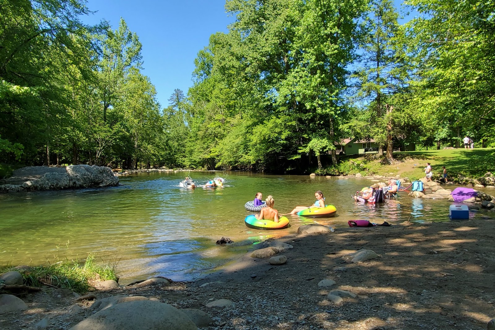
And in Tennessee, the Greenbrier Campground sports a pristine swimming hole, where kids frolicked 24 hours a day and old people plunked their chairs right down in the water to watch them, smoke and drink (moonshine, of course) through a lazy, hazy summer’s day.
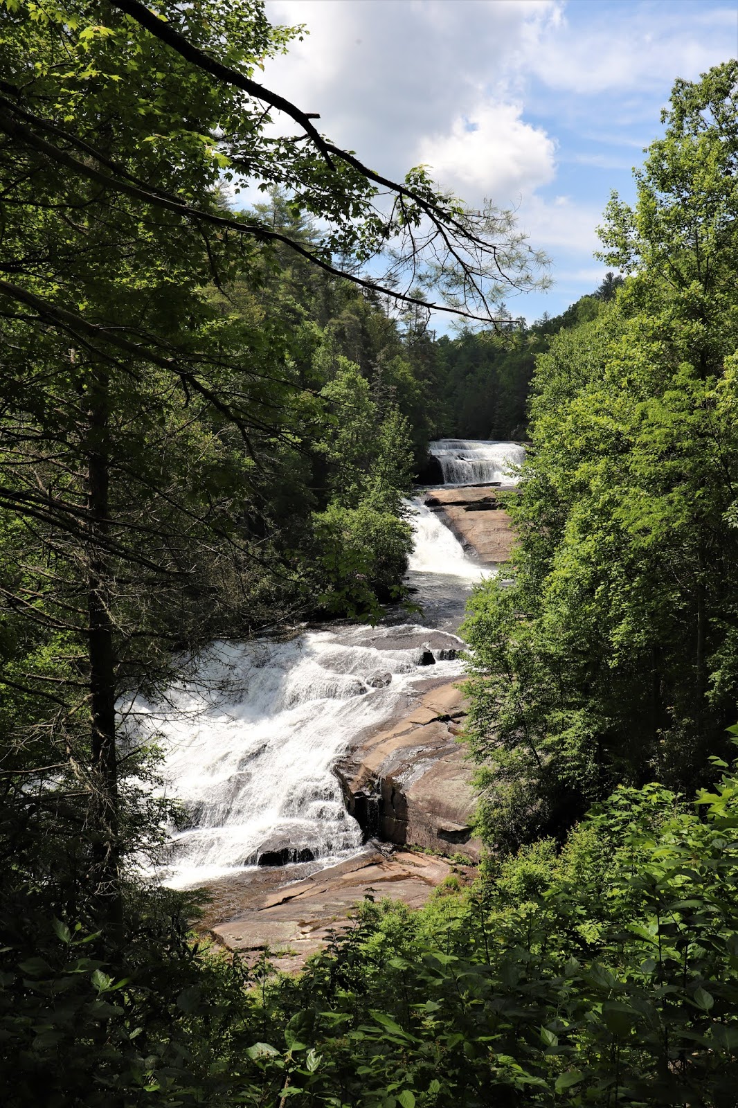
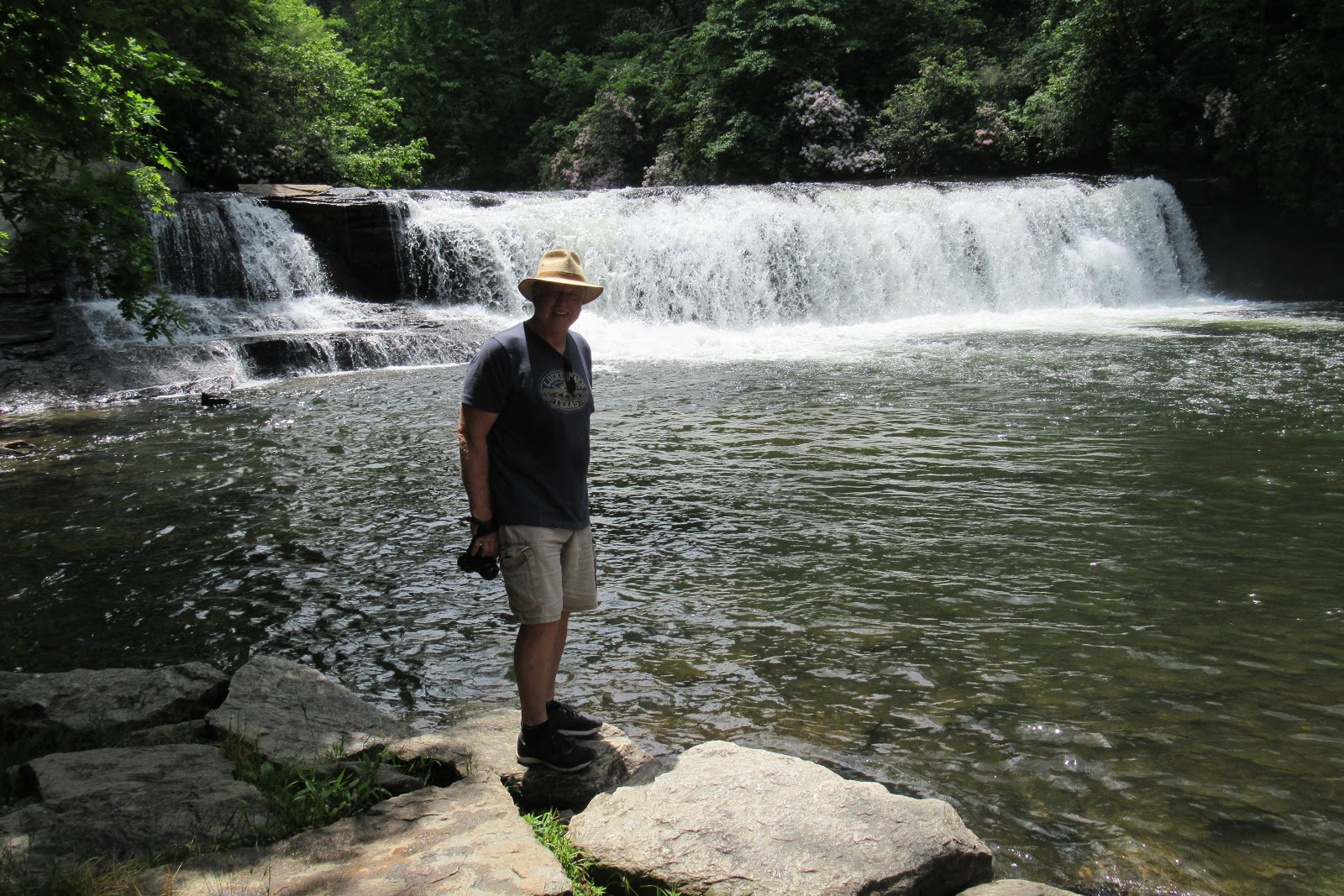
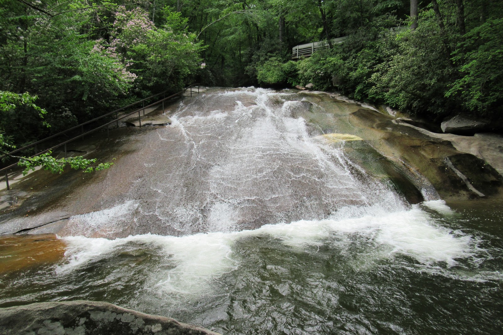
Leaving GSMNP, we spun through Brevard, North Carolina. Located between two National Forests (Pisgah and Dupont), Brevard offers hundreds of thousands of acres of beauty and a plethora of reasonably-accessible waterfalls. Here are just a few of our favorites, all dog-friendly!
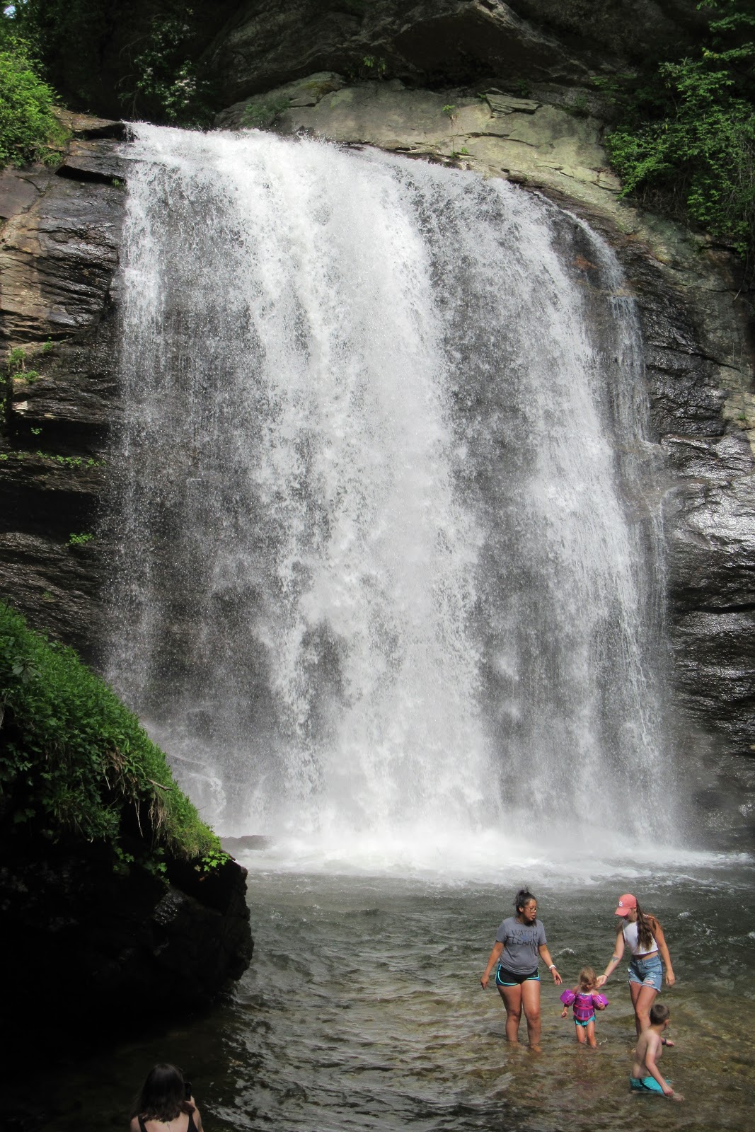
Looking Glass Falls
a short hike down a series of boardwalk stairs to a 60-foot beauty and swimming hole
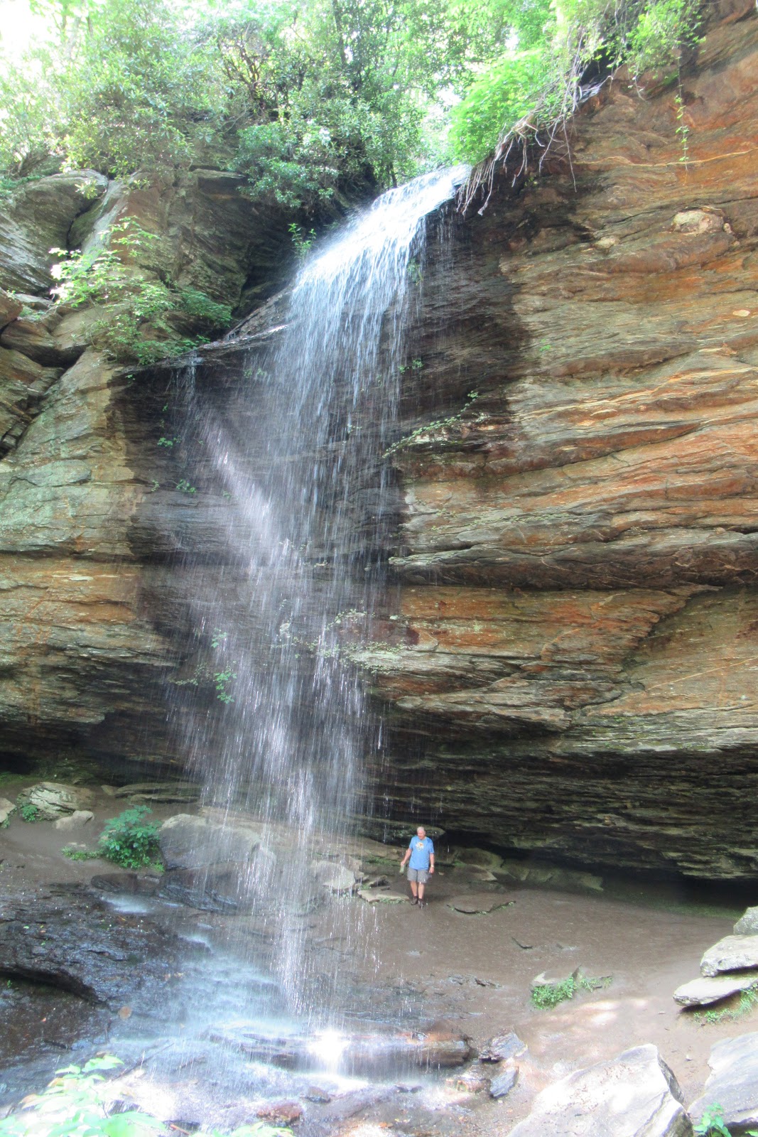
Moore Cove Falls
an easy 1.5 mi round-trip hike to 50-foot falls that you can walk under and behind
Triple Falls
1.2 mi steep round-trip hike to different observation levels, where some of the scenes in the original Hunger Games movie were shot
Hooker Falls
1.3 mi RT hike to a popular swimming hole with an unfortunate name (same parking lot as Triple Falls)
Sliding Rock
at 55 degrees and with 11,000 gallons of water a minute cascading across the 60-foot rock face, either bring your swimsuit or enjoy watching the shocked faces as sliders are dumped into the 8 foot pool at the bottom
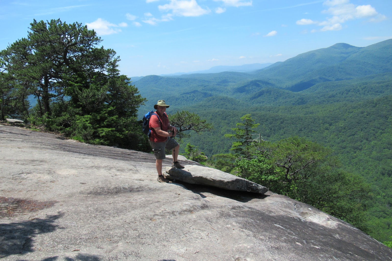
And finally, in the Brevard area we took the storied hike to the top of Looking Glass Rock. This strenuous 6.4 mi trail with 1728 foot elevation change redeems itself only by virtue of a rewarding end point with a great view.
And with that, we’re 2/3 through this 3-month trip. With lots of attractions still closed due to Covid, we’re happy to have been in destinations with plenty of outdoor recreation! Next up …. we’re heading back to South Carolina, with a stop in beautiful Greenville.


Such beautiful country! I haven’t been there in 50 years — on my list to see again. So glad you’re able to continue to adventure during these times. I’m counting down the months until the vaccine is here. Be safe and thanks for sharing your travels!
Hi Mo!!!! I sure miss seeing you! I think your list of places you want to see is getting long enough, that it's time you got yersef an RRRRR-VVVVVVV !!!!
Your photos are great! It's so cool to see the park so green and lush. When we visited last fall, the colors were fading and it just felt very different. We missed out on Cades Cove, so thanks for the tour. We tried to do another smaller one-way loop and gave up quickly once we realized we'd be spending all afternoon parked in traffic.
Thanks for the tip on the Just Ahead app. I've never heard of it, but it sounds great – especially for enormous parks full of random cool stuff that we'd never know about otherwise. Brilliant that it works off GPS instead of cell signal, too. We're heading back to Yellowstone in a couple weeks, so I'll definitely grab a copy.
Finally, I love that you brought happy hour chairs up to Clingmans Dome. Now, that's planning!!
Ahhhhh I could always say the same about YOUR photos! We were talking about what it might look like in the fall or winter, I bet beautiful in a totally different way. And, don't tell anyone, but we ALWAYS have happy hour chairs at the ready in our tow vehicle! Never know when there might be a rum and coke emergency situation needing our full attention!
We love GSMNP; Gatlinburg, not so much. One of my favorite memories of that Park was from the time our son, Ryan, was two. We were on a horseback ride through the forest, and he pointed out a deer that the guide had missed. Nothing like being shown up by a toddler. Thanks for sharing all the waterfalls pics – waterfalls are one of nature's special treats!
OF COURSE you feel the same about GSMNP and Gatlinburg as I do, because WE ARE RV SISTERS …. maybe even twins!!!! Hope you are doing well and enjoying your summer so far!