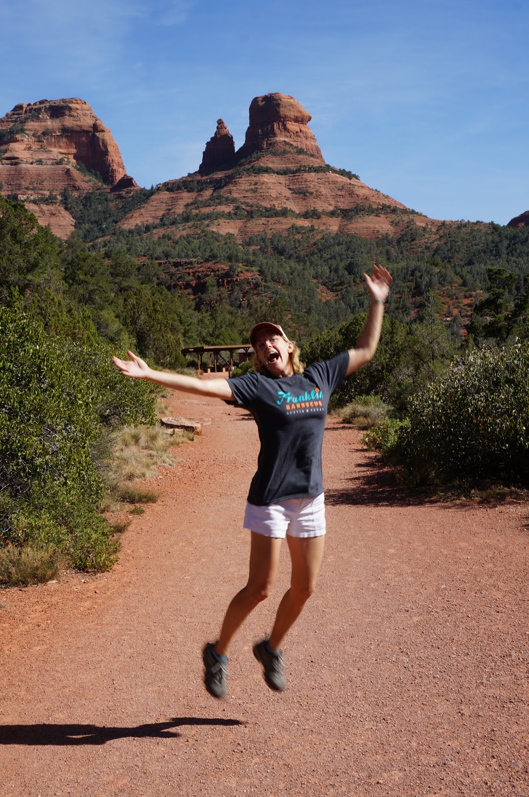
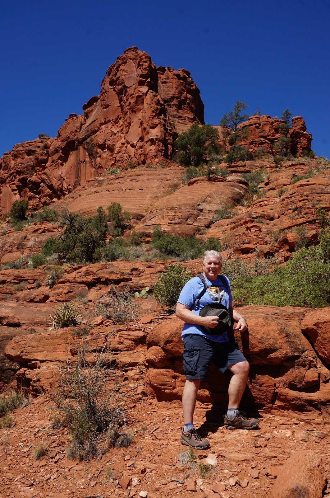
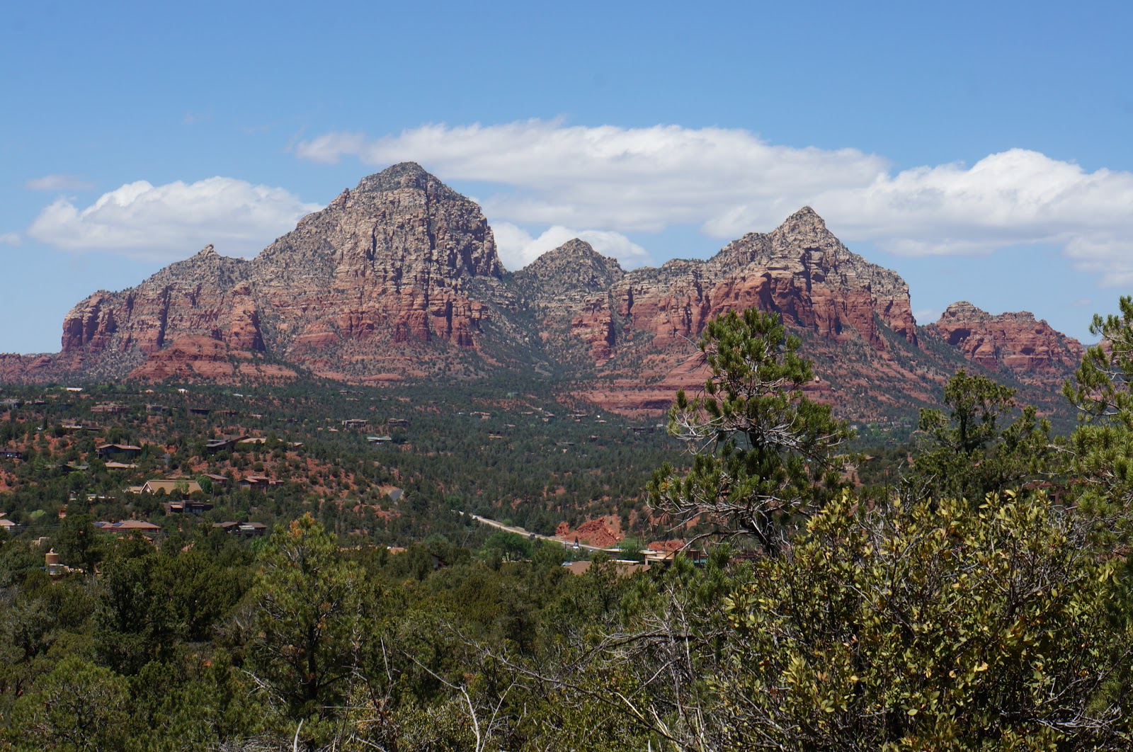
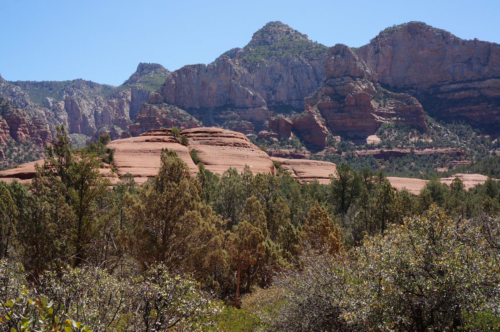
No doubt, Sedona is beautiful and Sedona is magical. But its REAL CHARM lies in its hundreds upon hundreds of well-marked, DOG-FRIENDLY hiking trails. Just two hours north of Phoenix, it’s the perfect place to indulge in a little trail-lust!
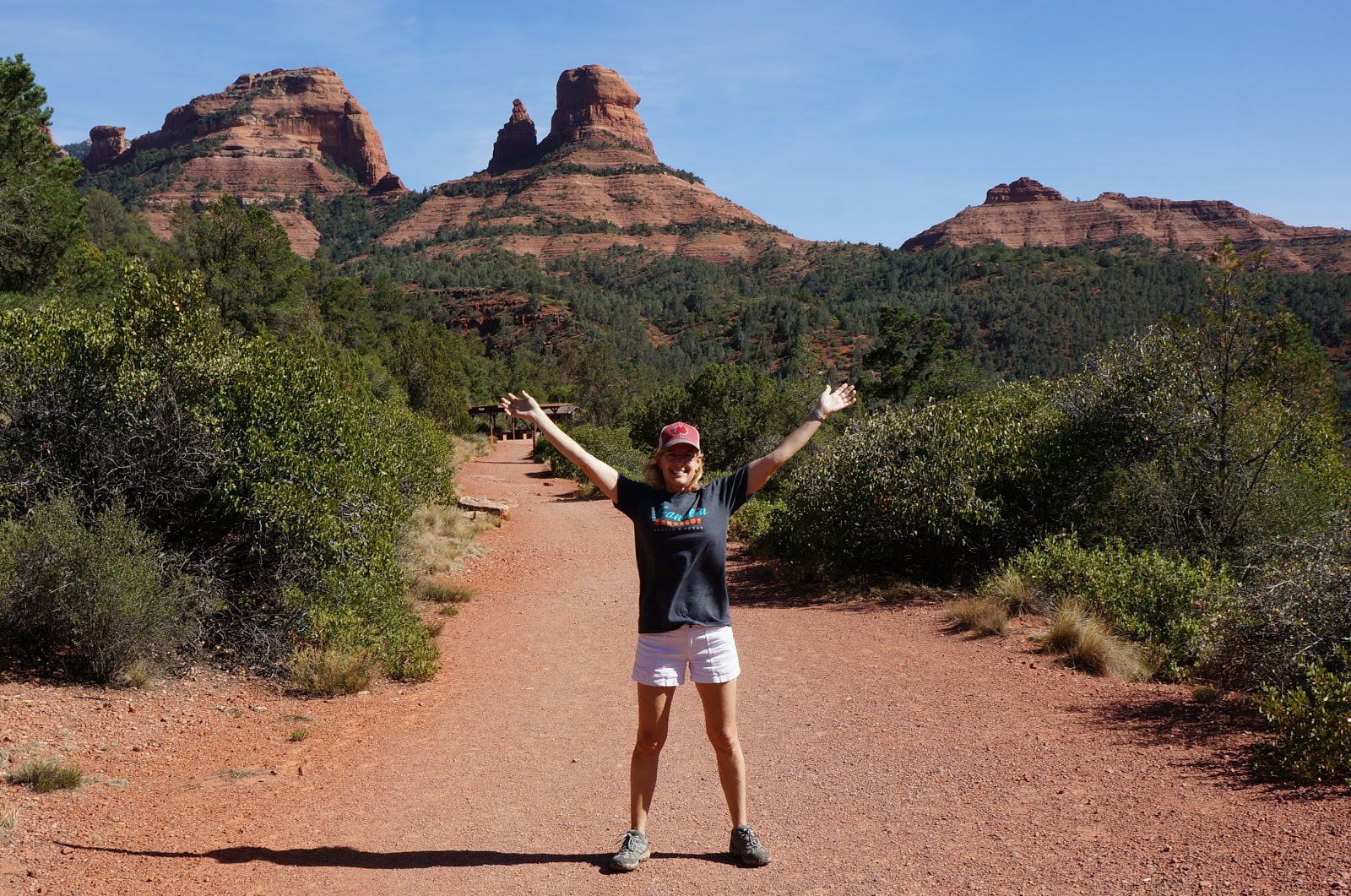
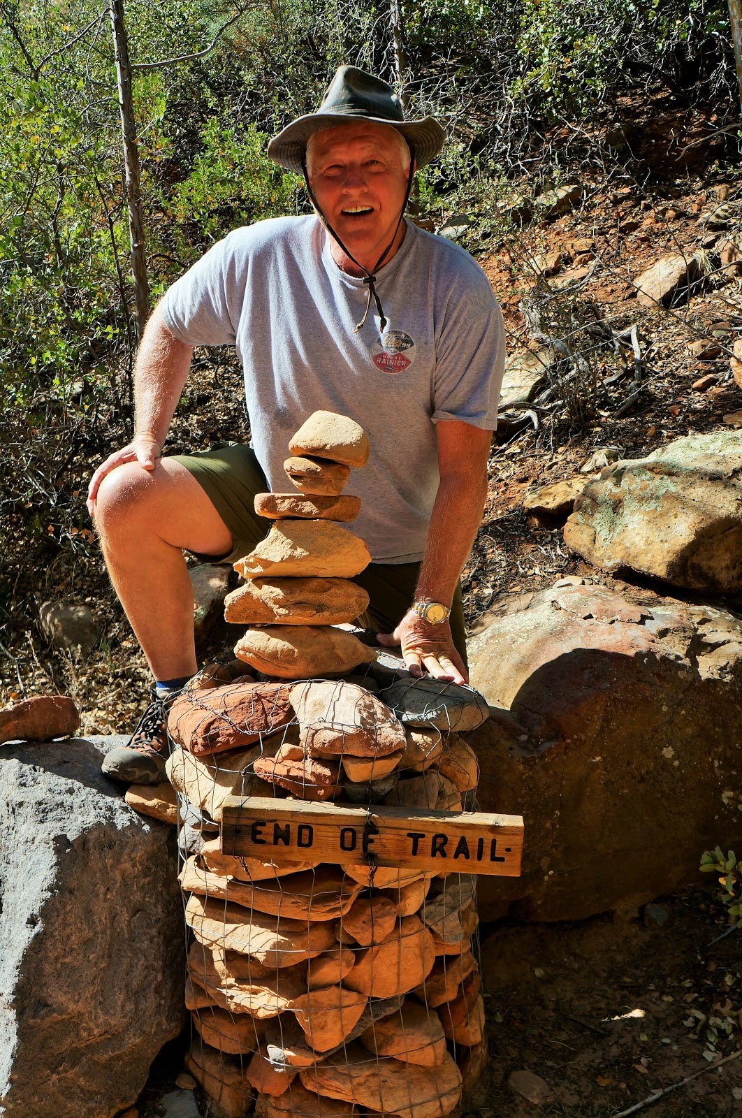
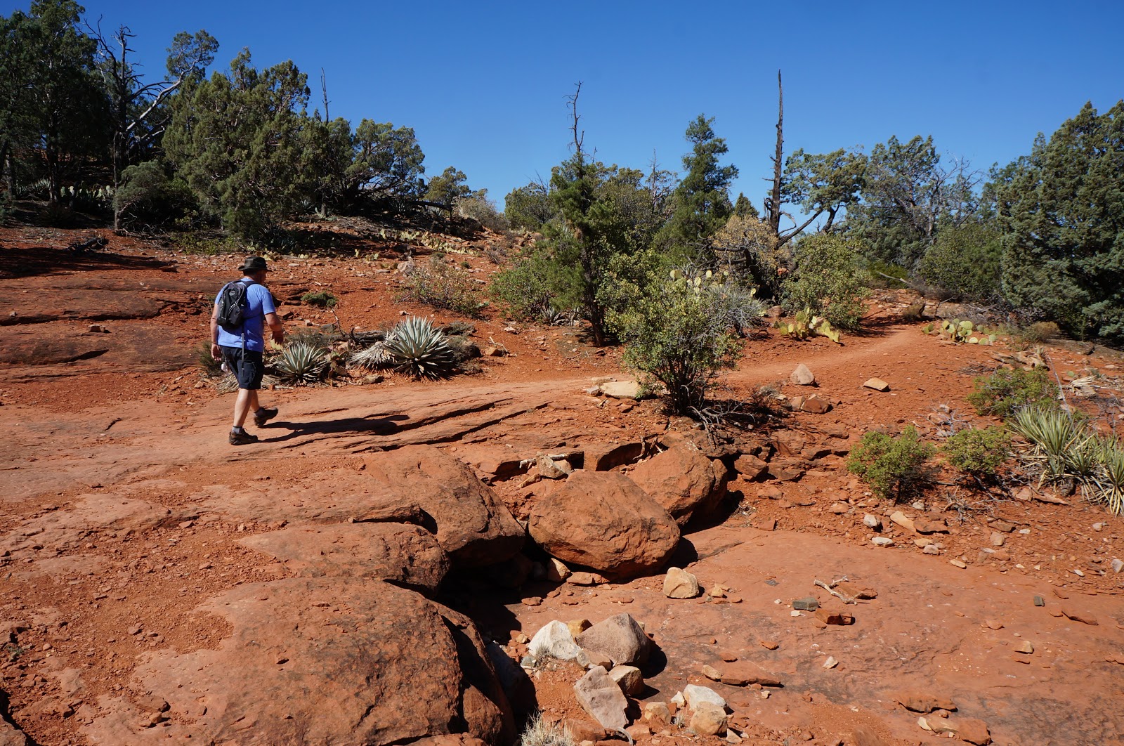
We had a goal … errrr, uhhhhh, Philip had a goal, and I had no choice but to go along with it. He wanted to hike at least 25 miles in 5 continuous days, an admirable goal under any circumstances, but particularly because five weeks ago, he was hit by a car while riding his bicycle on Indian School Road. He had finally been cleared for rehab and rehab-like-activities like hiking. So, off we went to conquer just a teeny tiny bit of this:
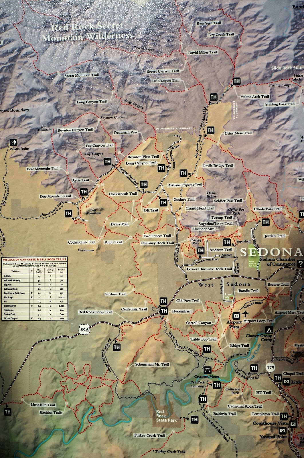
You can find a lot of information about Sedona hiking trails online. Much of it incorrect or misleading, I might add! Wise to doublecheck trail distances etc. a couple of different places before heading out. Here are the trails we conquered and loved!
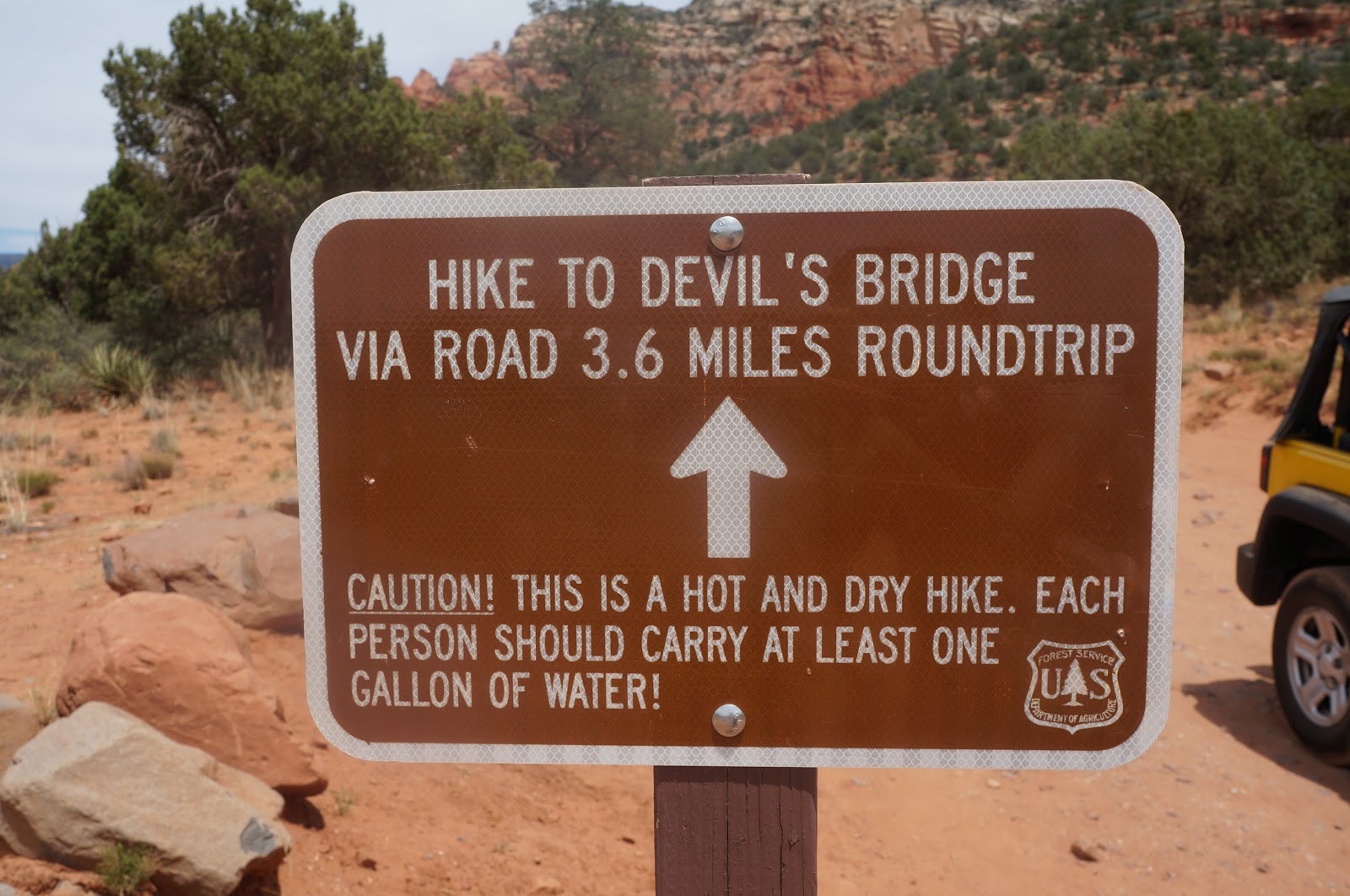
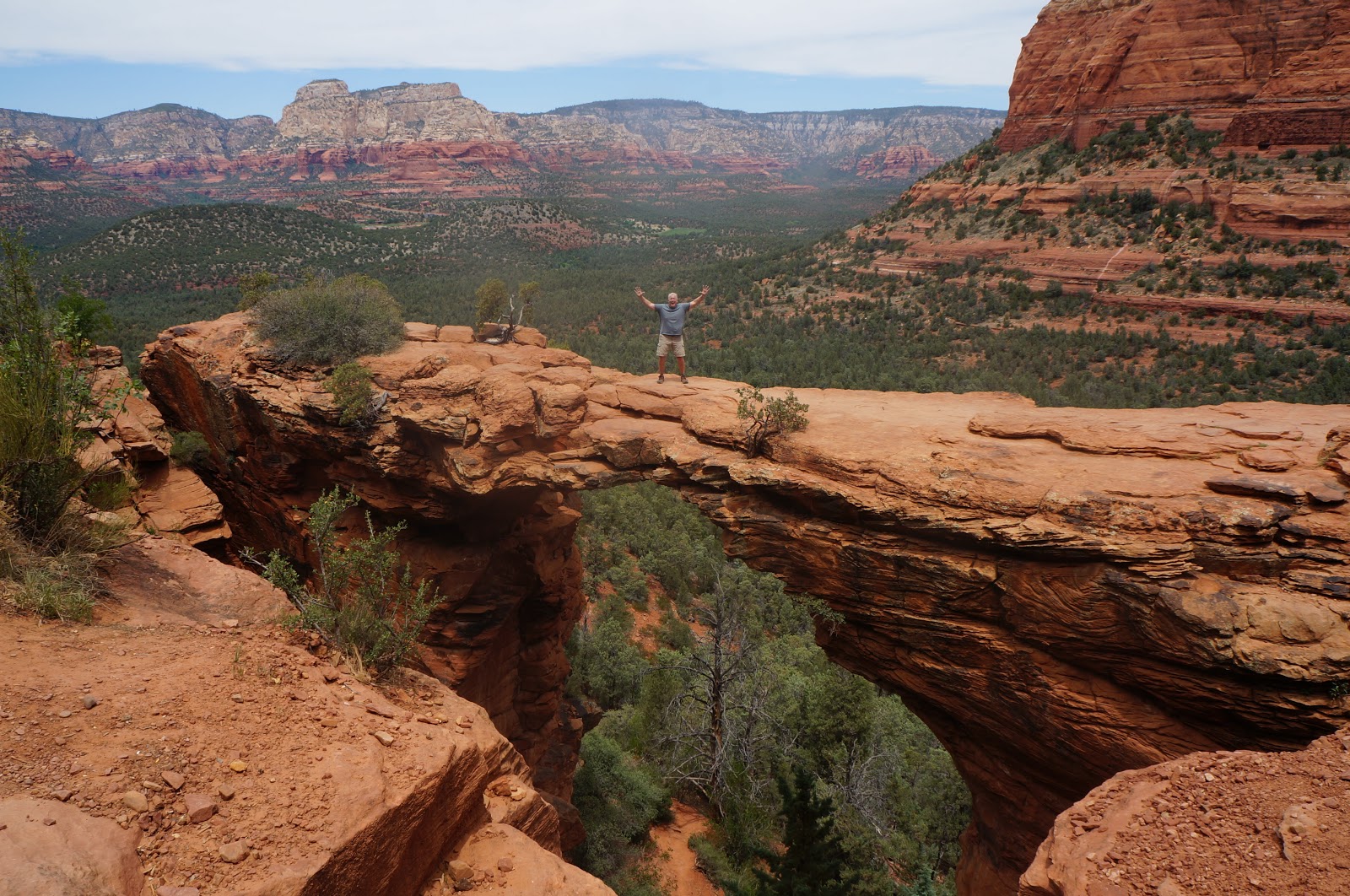
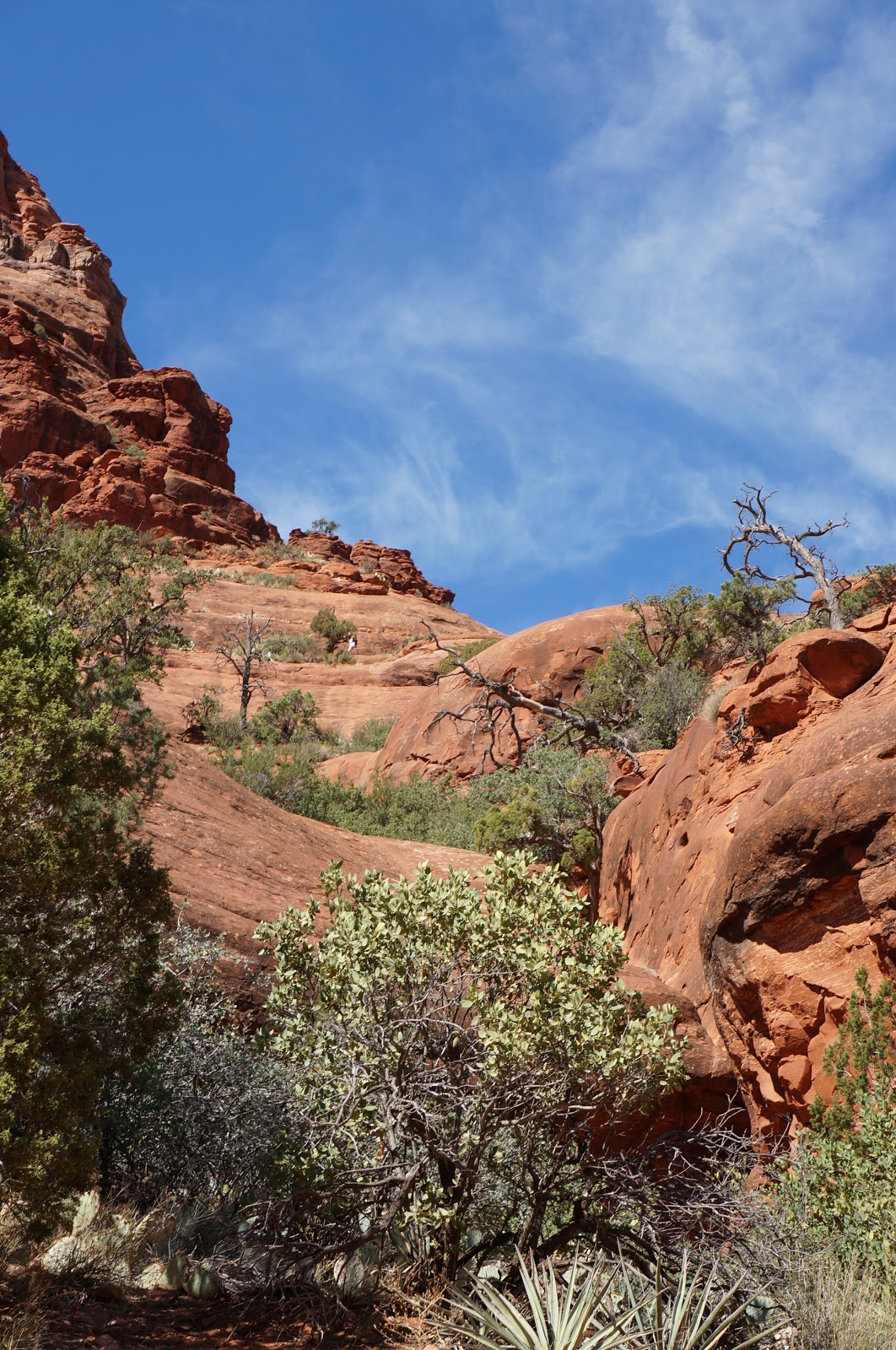
DEVIL’S BRIDGE
5 miles RT (out and back)
The Big Fallacy: it’s a 1.5 mile hike. Well, yah. But first ya gotta get to the trailhead! Add 3.6!
SUMMARY: An iconic Sedona hike with a fabulous photographic payout at the end!
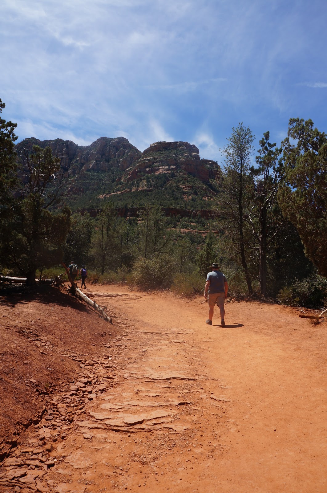
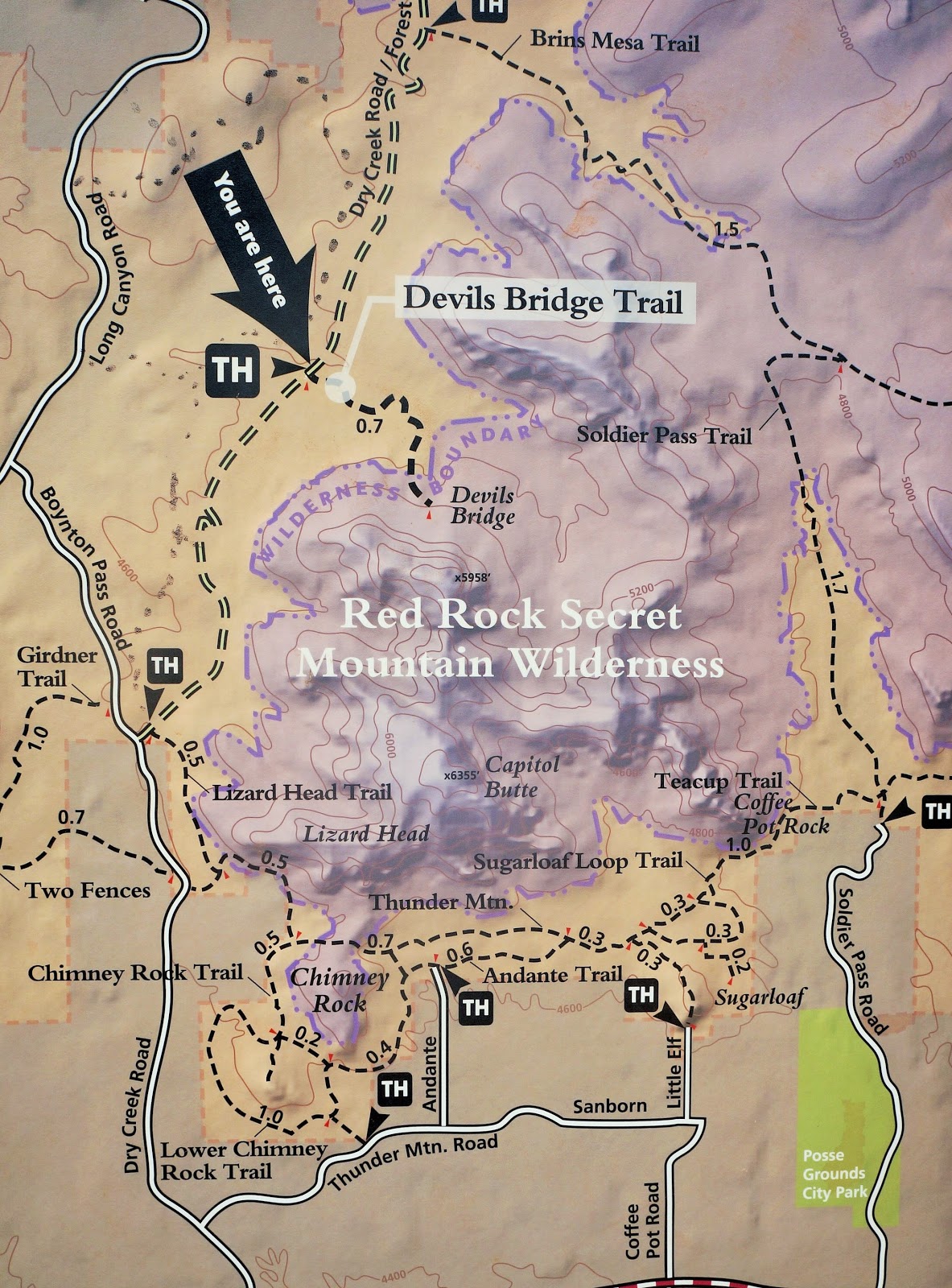
This hike is accessed off Dry Creek/Boynton Pass Road, off 89A in West Sedona.
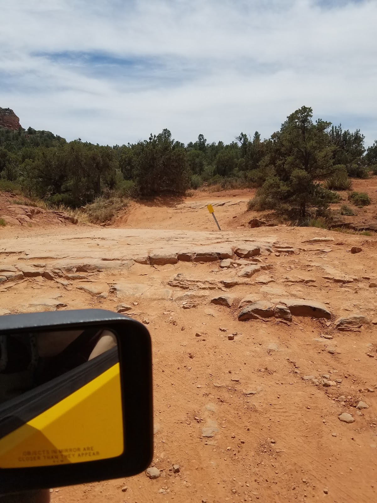
Start with a 3.6 mile RT hike along a dusty, boring road to the trailhead.
If you have a 4WD vehicle, you can drive part or all of this road.
Very rough, very rocky.
Besides the 3.6 RT on the road, it’s 1.4 RT from the trailhead to the Bridge.
Some shade, but not much. Starts out flat, quite steep toward the top.
Gorgeous views in all directions!

And the big-money destination: Devil’s Bridge! Don’t look down! WOWZA!!!
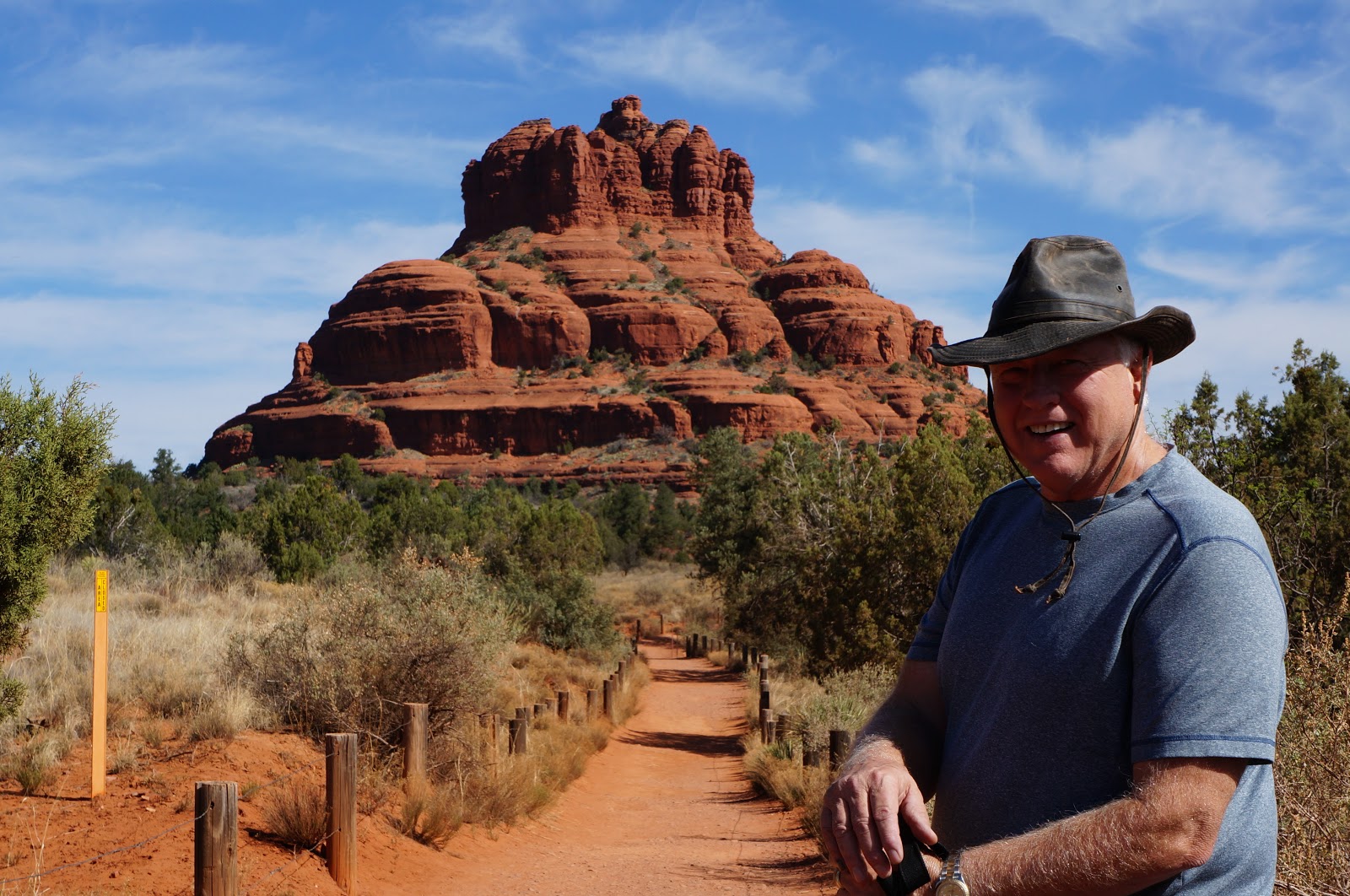
BELL ROCK LOOP
1.5 mi hike (lollipop – out-loop-back)
The Big Fallacy: it’s a 3/4 mile hike. Well, yah, if you helicopter in!
Otherwise, add another 3/4 mile to get to the loop!
SUMMARY: suitable for everyone 2-92 years old, easy and pretty. Good warm-up hike!
This hike begins in the large parking lot south of Sedona off Hwy. 179, where you must purchase a “Red Rock Pass” ($7/day or $15/week) from an onsite vending machine. Then meander along the Bell Rock Pathway to the Bell Rock Loop.
You will be sharing this path with mountain bikers.
They will not give you advance warning of their approach.
At the loop, you can choose to climb up …

Or, loop around “low” and enjoy beautiful views along flat trails.
Plus side: easy to get to.
Minus: zero shade. literally zero.
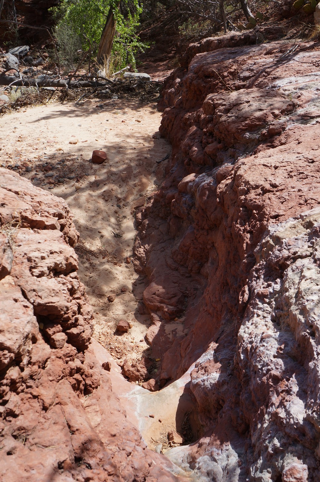
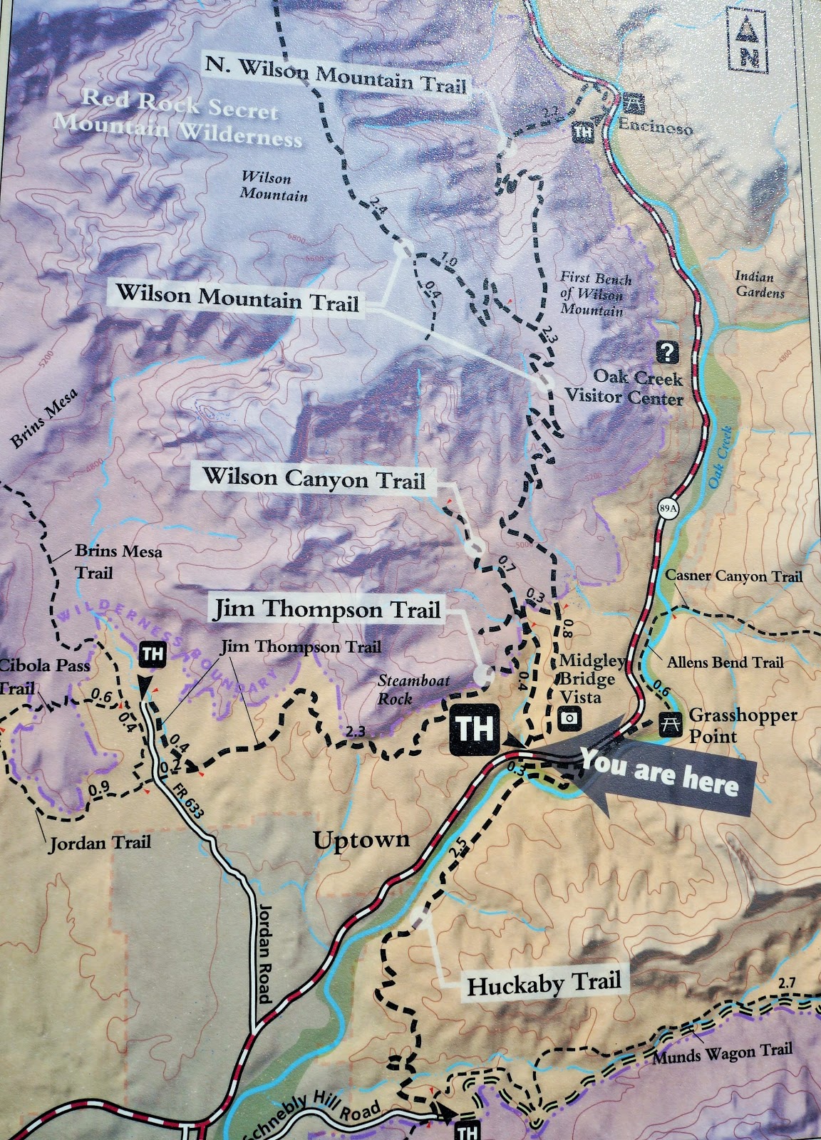
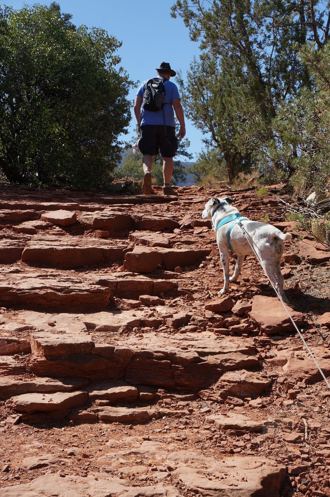
WILSON CANYON TRAIL
3.0 mile RT (out and back)
The Big Fallacy: This trail has lots of water and creek crossings.
Ummmm … not in mid-May, it doesn’t!
Summary: a quick-n-easy, fun to follow trail with little traffic!
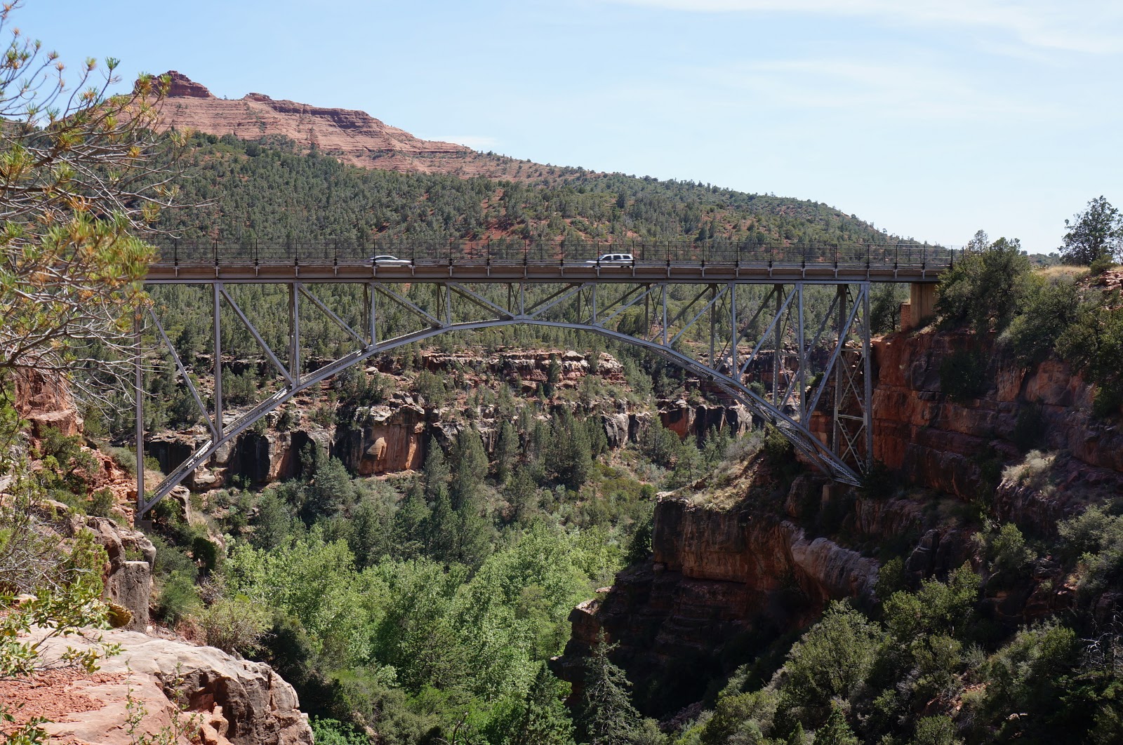
This trail is accessed from a small parking lot just over the Midgley Bridge, a few miles north of Sedona. Again, you’re gonna need that pesky Red Rock Pass to park there (vending machine onsite).
This trail has lots of low-grade, doable climbing and twists and turns. Lots of shade, lots of fun!
What it doesn’t have … running water through these dry creek beds.
Though if it did, we would have crossed the creek at least 10 times on the trail.
In case there was any doubt, helpful labels are there for you!
The best part … nobody there! We were the only ones on the trail the entire time. Oh, happy day!
Disclaimer: be sure to take Wilson CANYON (not Wilson MOUNTAIN) or it’s a-gonna be a whole different experience, and not in a good way.
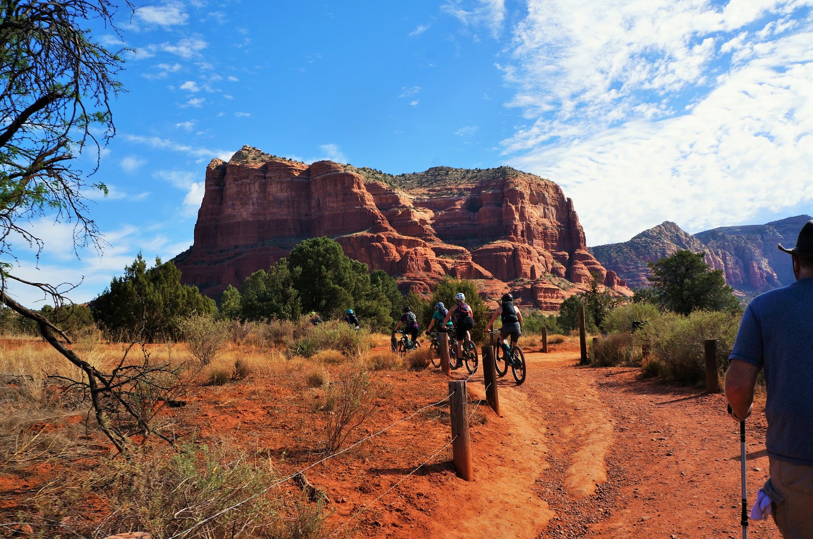
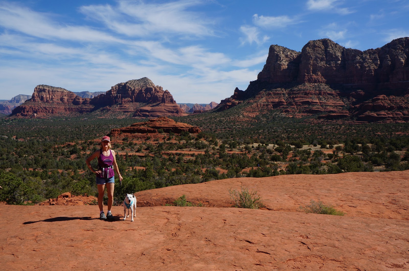
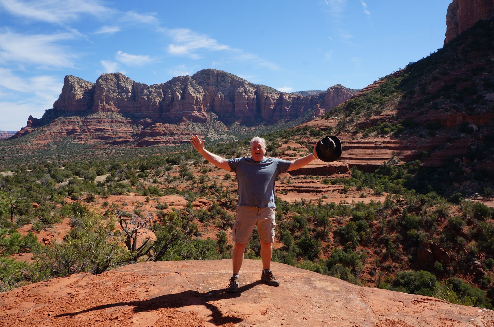
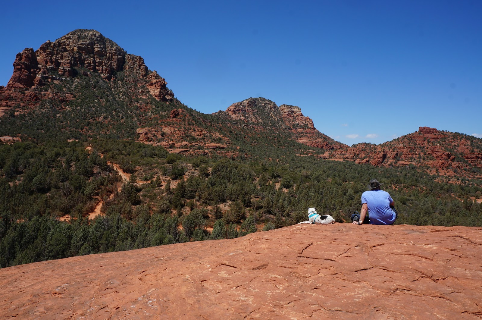
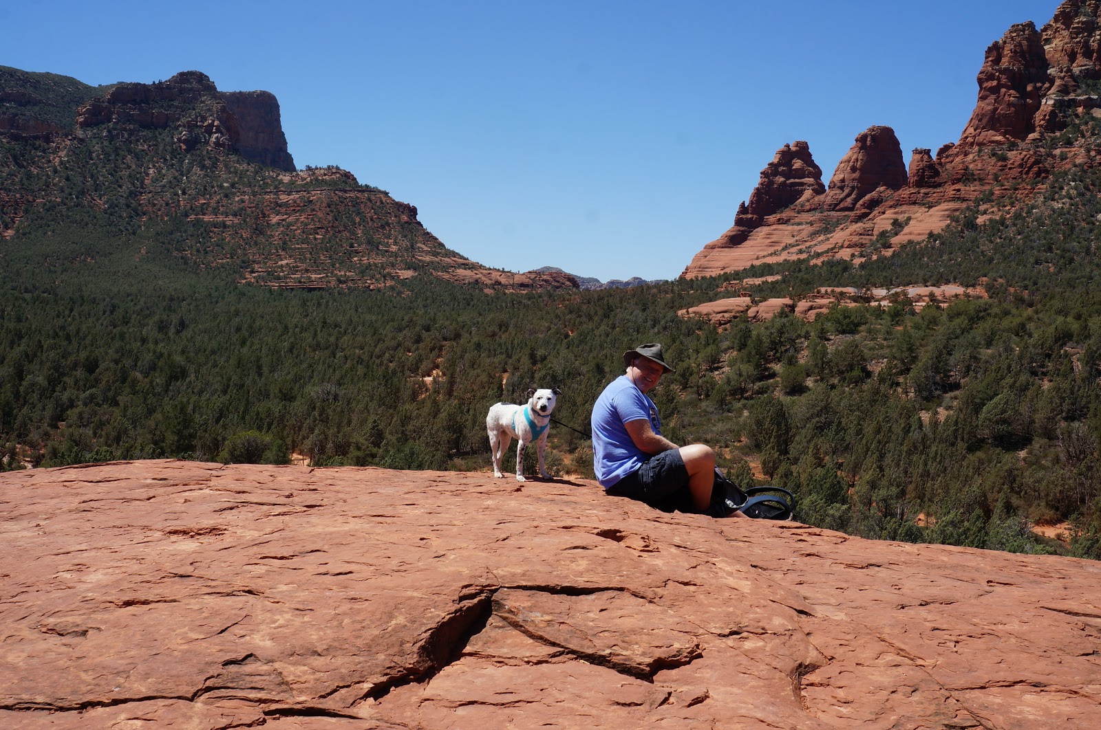
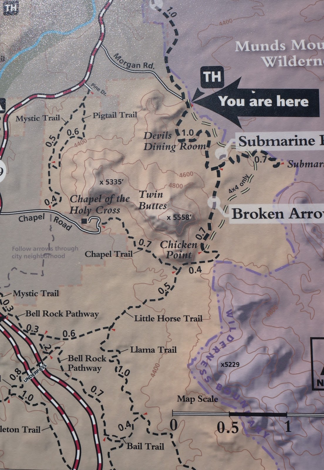
MARG’S DRAW to LITTLE ARROW to SUBMARINE ROCK
6.63 miles RT (out and back)
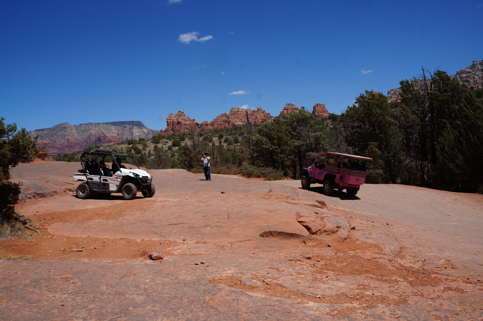
The Big Fallacy: all Sedona trails offer peaceful contemplation and the solitude of nature.
Not so much, not this one! A busy 4×4 road runs alongside a lot of it.
SUMMARY: This trail has lots of pretty sights, moderate inclines, and a big ole rock shaped like a submarine!
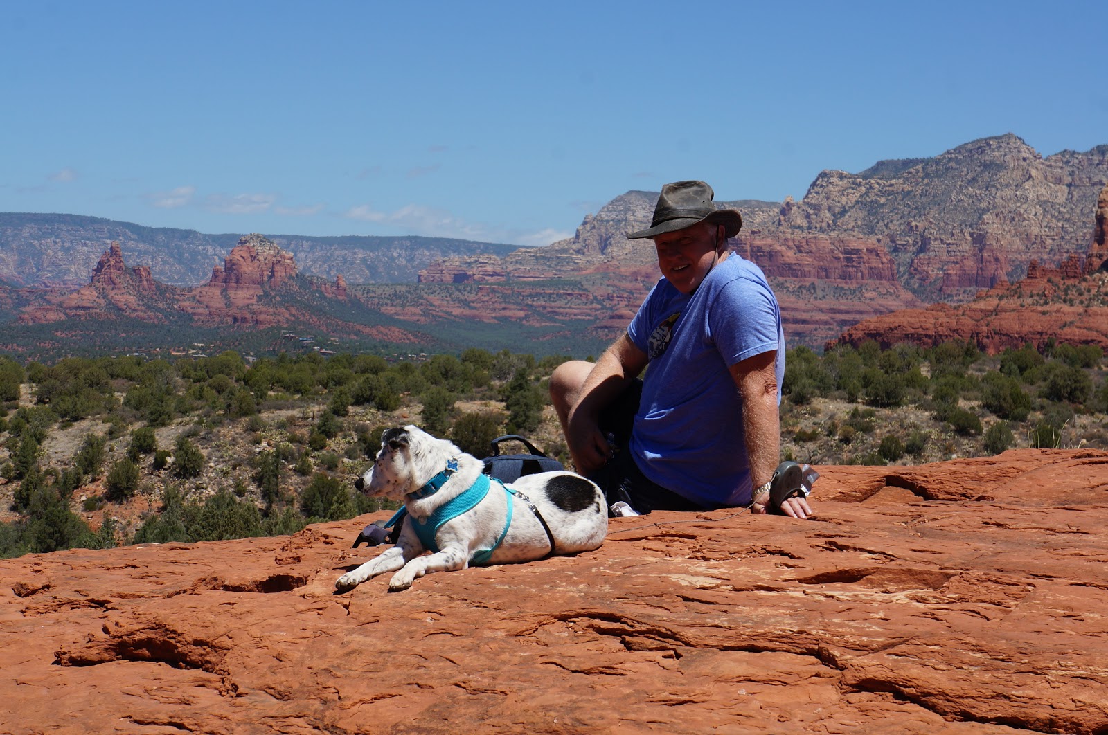
We loved the varied terrain in this area …
… with lots of beautiful scenery all around, both up close and far away.
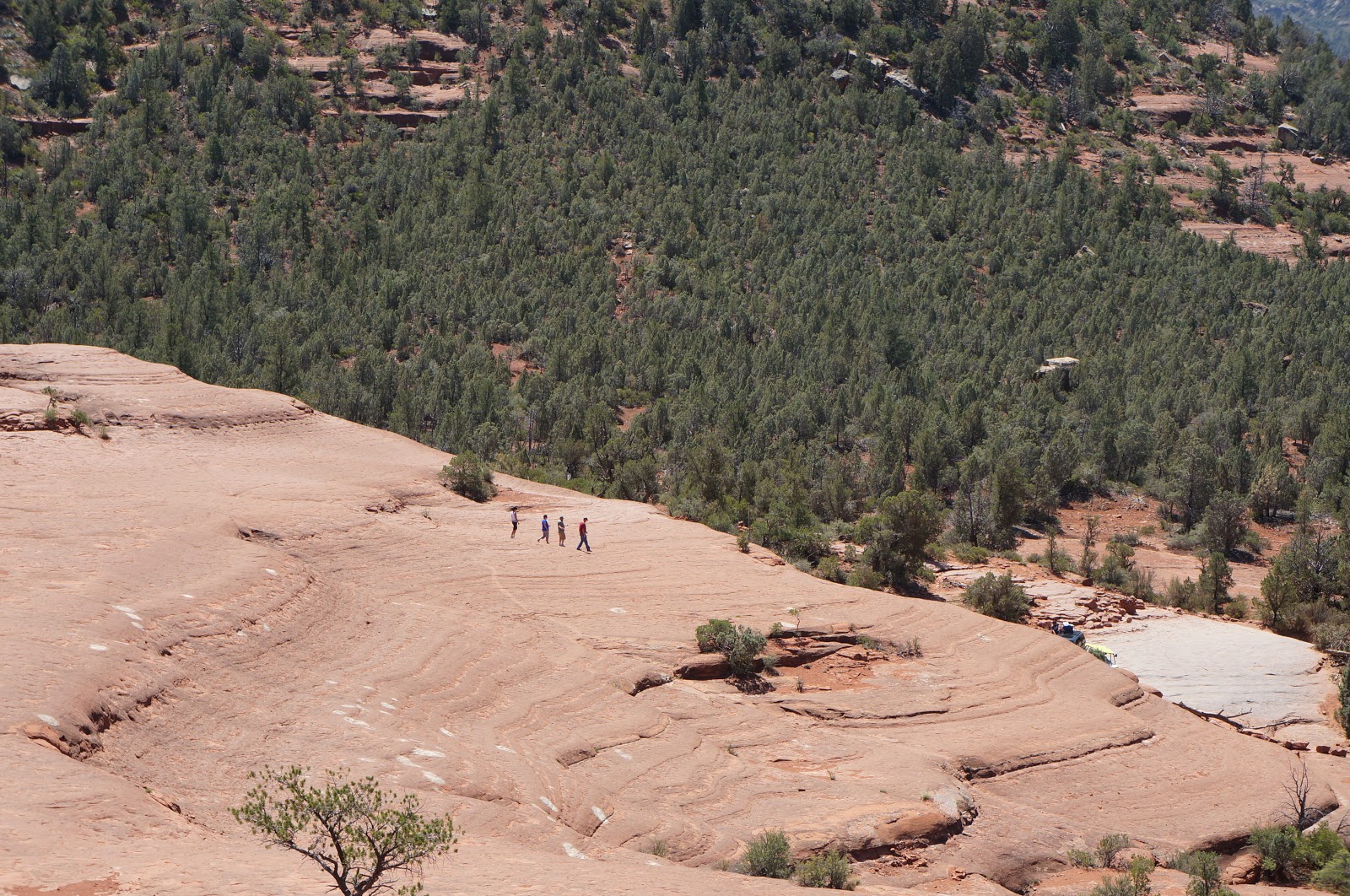
Submarine Rock is so named not only for its shape, but also its size … about the same as a real submarine!
Can you see the teeny tiny people below? Those lazy bums who rode a Pink Jeep Tour to the rock are at least good for scale.
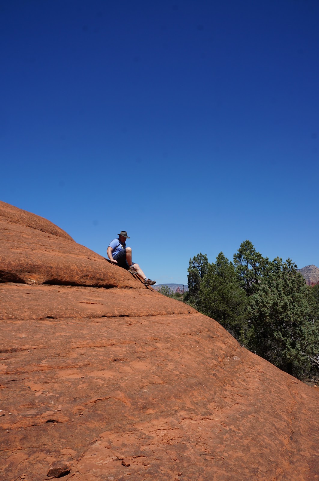
After scrambling up the slickrock to the tippy top of Submarine Rock …
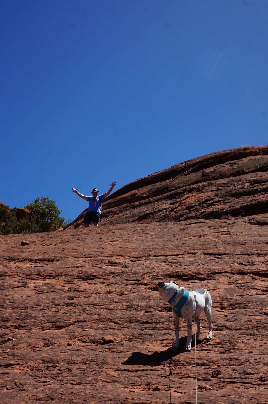
you are rewarded with some dog-gone awesome views in 360 degrees!
What goes up, must go down. In this case on your butt! Sedona rock is soft and slippery!
As mentioned previously, rock crawlers and 4-wheelers abound in this area!
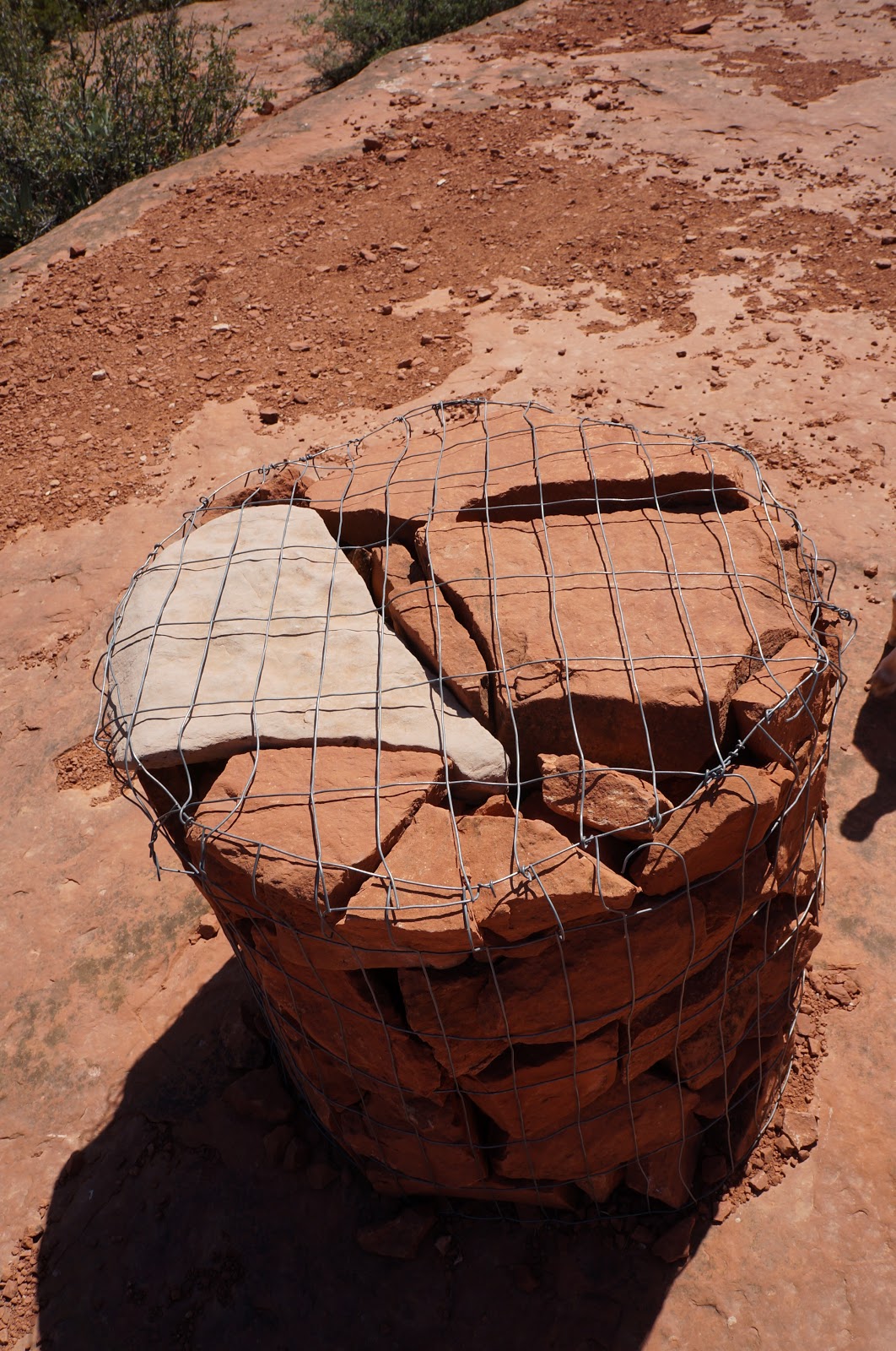
Somebody failed “Red Rock Cairn Building” Class. “NO, Billy Bob, they are ALL supposed to be red rocks”
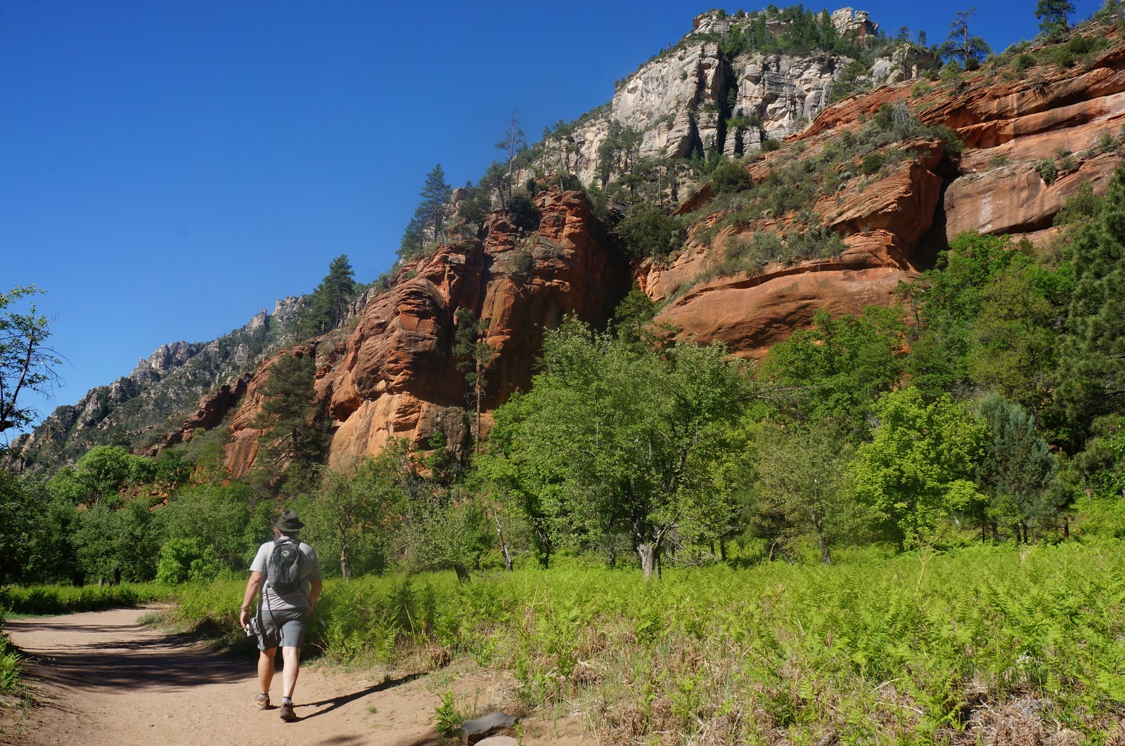
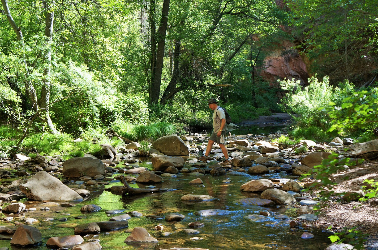
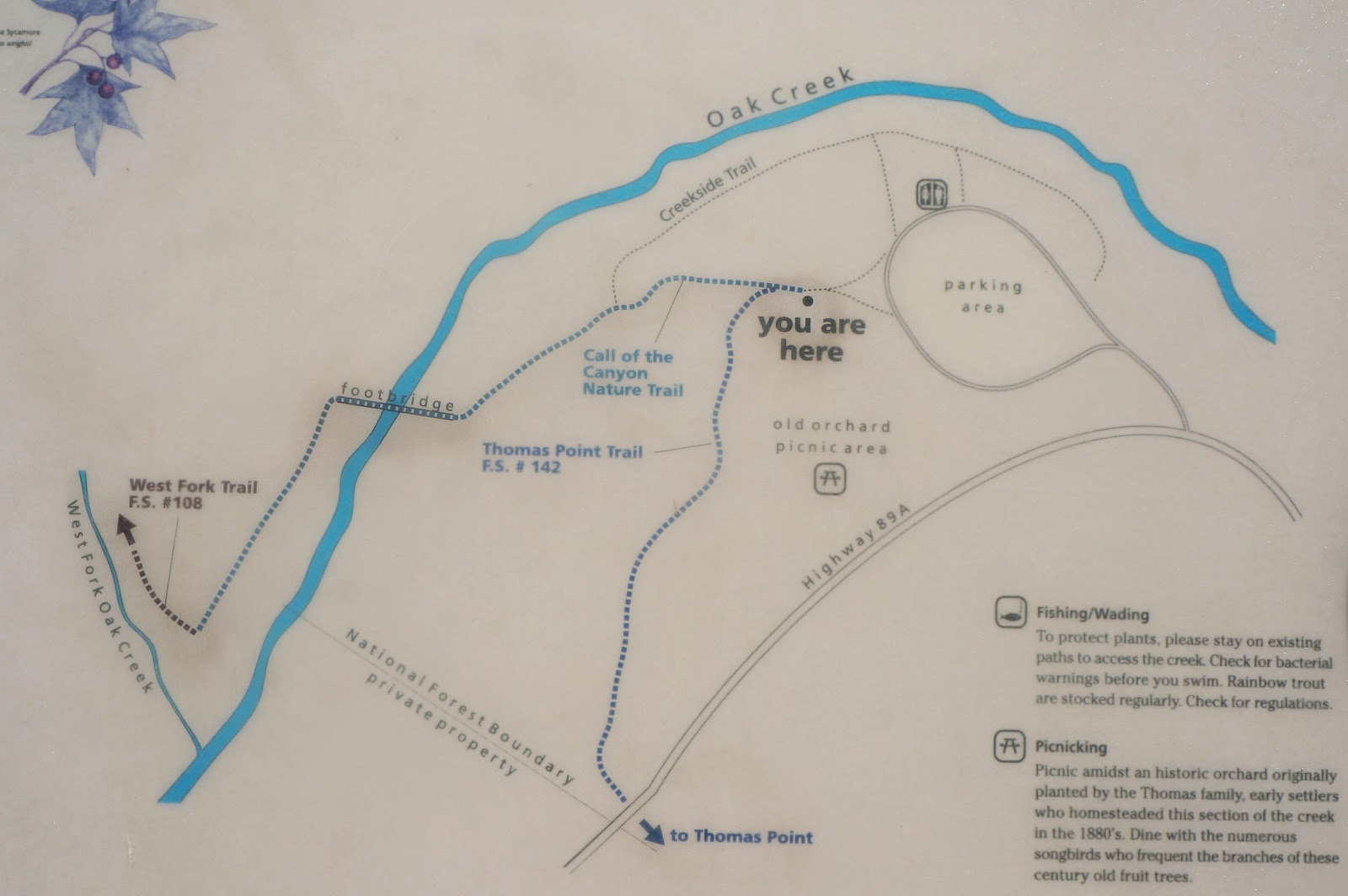
WEST FORK OAK CREEK
6.9 miles RT (out and back)
The Big Fallacy: Do this hike any time of day. Oh no — you’d better get there EARLY!
SUMMARY: Written up in Arizona Highways and touted as one of the best hiking trails in Arizona. With twists and turns, incredible views of canyon walls, and peppered with 13 creek crossings, it’s a lot of fun!
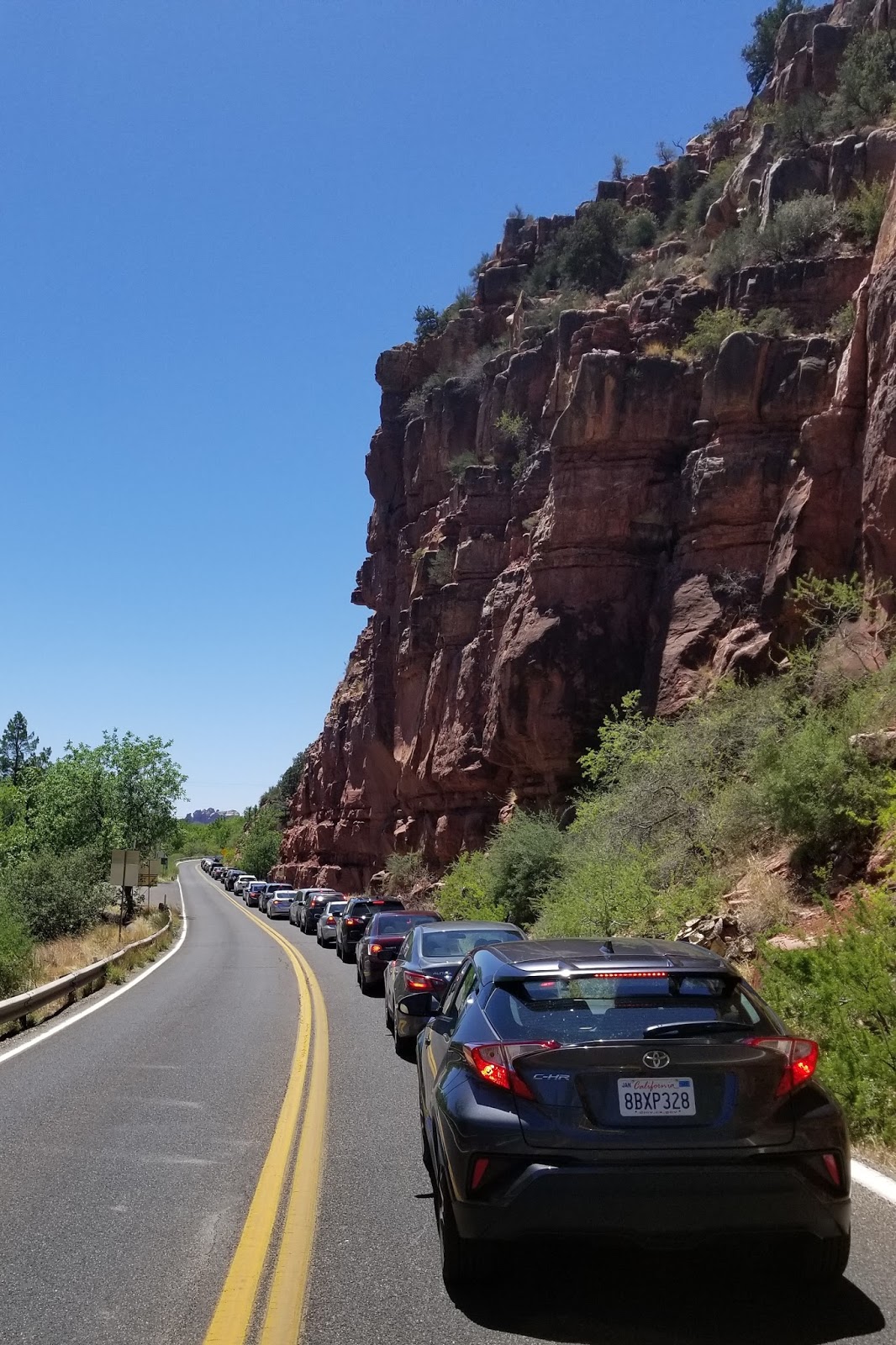
This place has a very small parking lot (relative to how popular this hike is) and when it’s full, you will be sitting in line at the guard gate waiting one-by-one for someone to exit. Gate opens at 8 and you can bet it will be full by 9 — and that’s on a nondescript weekday. Weekends and holiday weekends, cars are lined up 10 deep all day long ,waiting to get in. $10 fee.
Lots of fun creek crossings on rocks and logs.
All kinds of terrain, including fern gully.
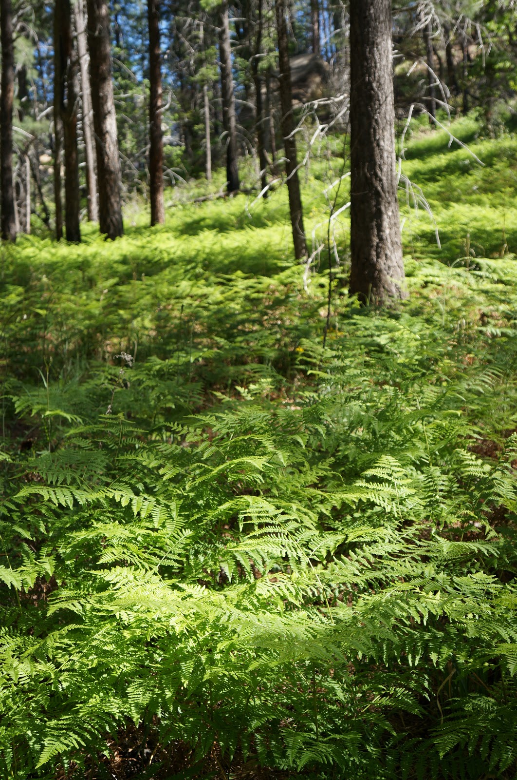
Beautiful tall canyon walls, giving lots of morning and afternoon shade.
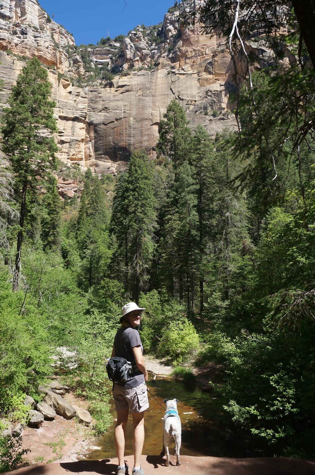
Plenty of places to stop off for a rest or a picnic.
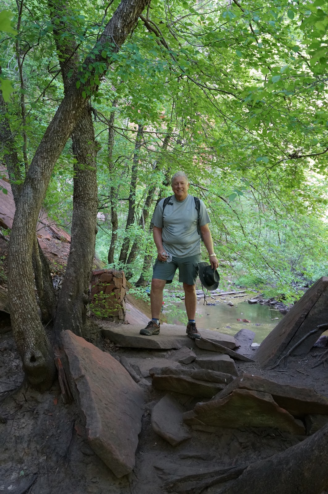
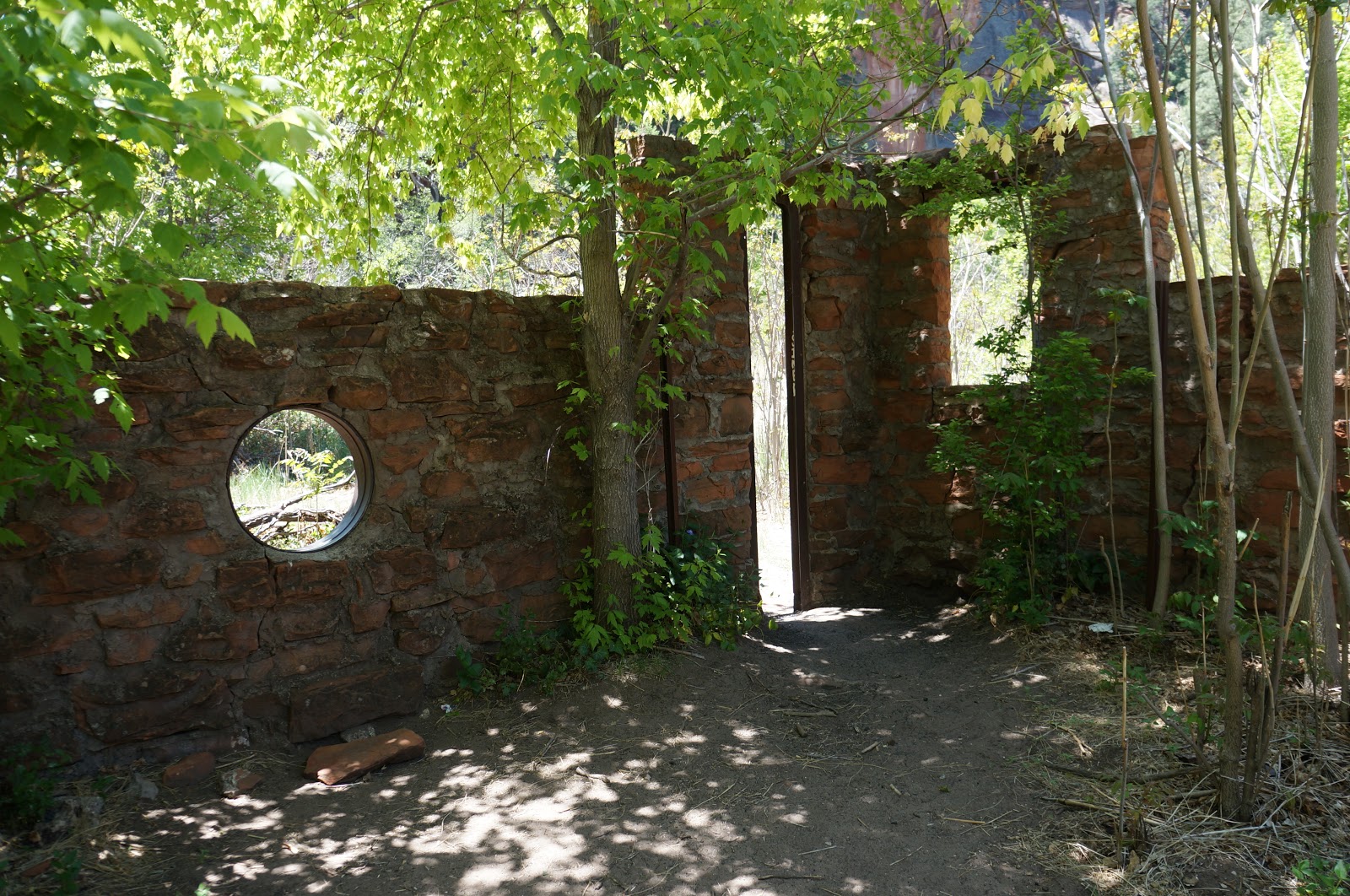
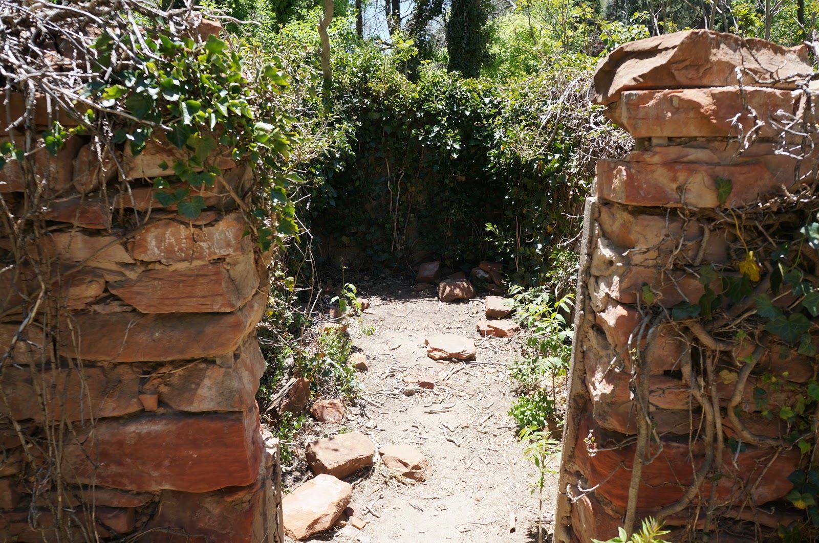
From 1926-1968, the historic Mayhew Lodge was located here. Notable guests included President Herbert Hoover, Jimmy Stewart, Walt Disney, and Clark Gable! Back in the day:
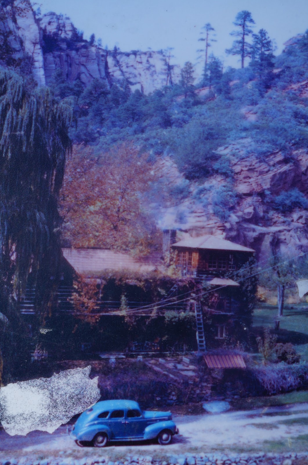
Remnants of the abandoned buildings still (barely) stand.
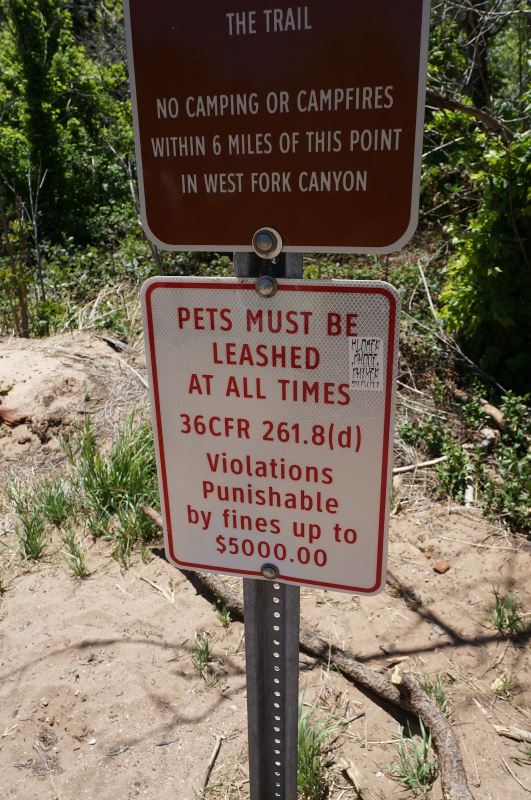
Word to the wise: I’ve never seen a potential fine THIS high before!
West Fork Trail really did live up to the hype. It was spectacular!
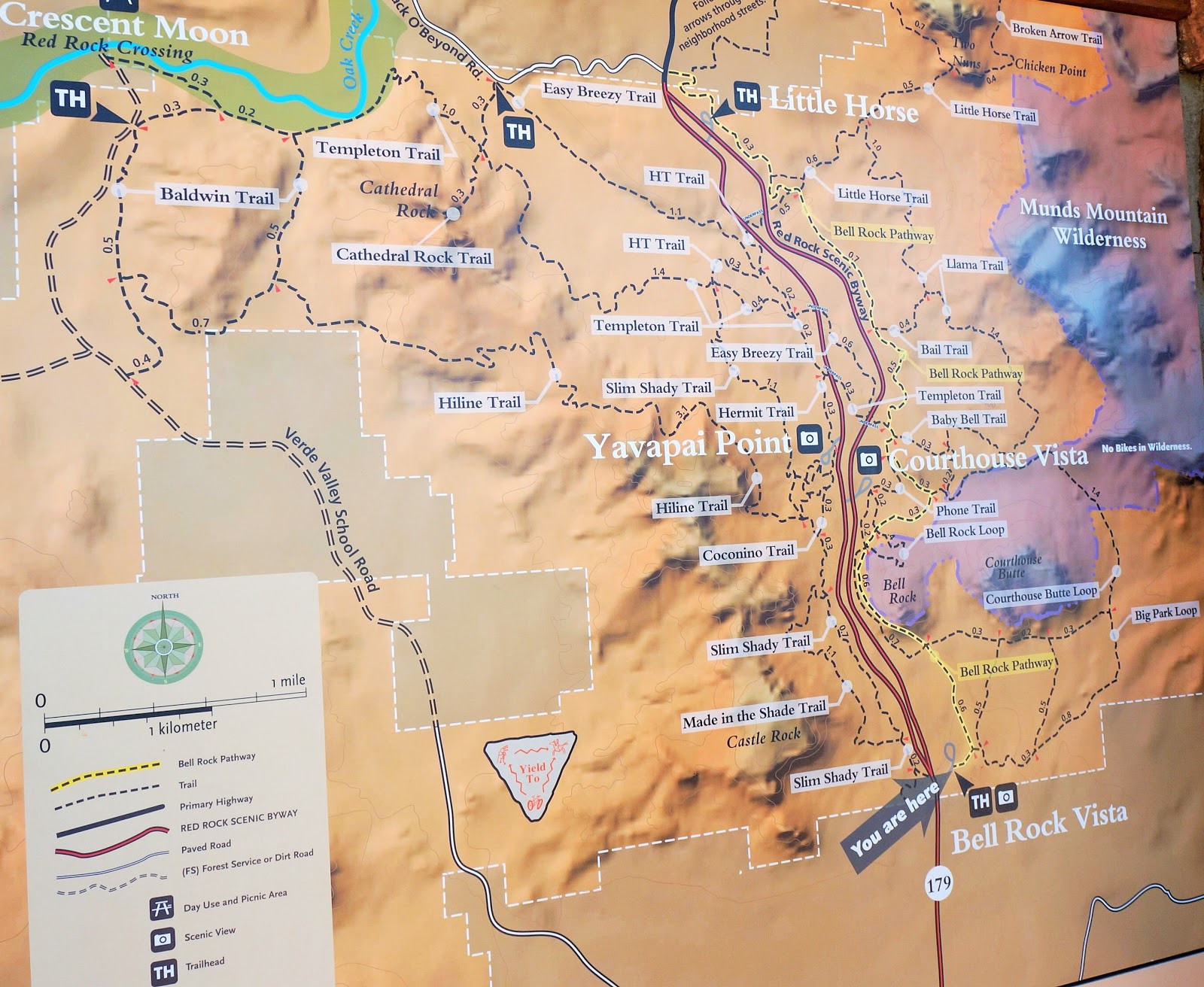
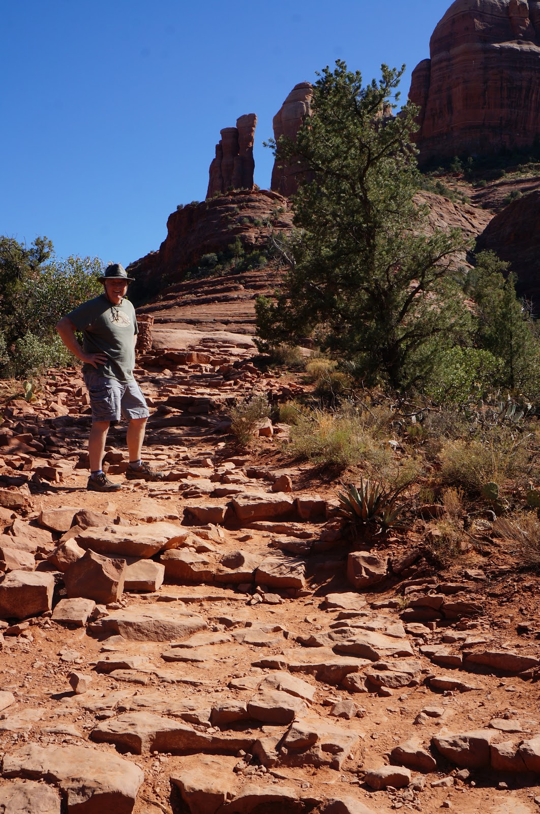
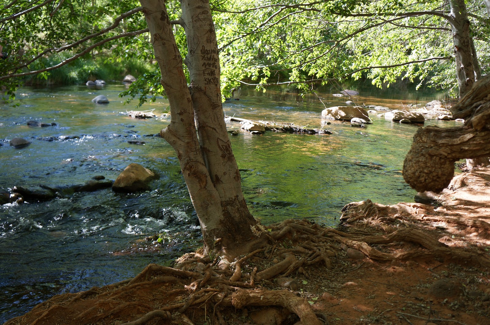
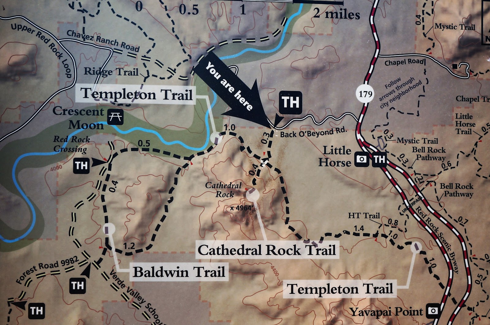
TEMPLETON TRAIL (via CATHEDRAL ROCK)
3.10 miles RT (out and back)
The Big Fallacy: You have to hike a long way to get to cool water. Not with this trail, you don’t! It’s not far from the highway and in just 1.3 miles, you’ll be coolin’ your heels in the rushing waters of Oak Creek!
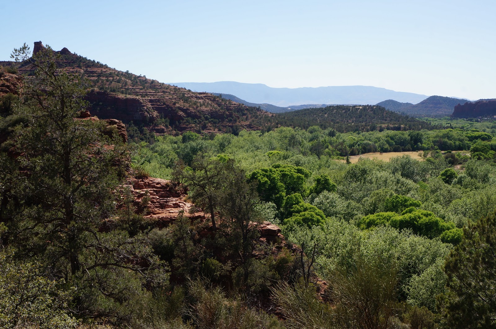
SUMMARY: With a trail that hugs the side of the mountains, leading to a cool green valley with lots of waterside rest or picnic spots, it’s a very “doable” hike for anyone, anytime.
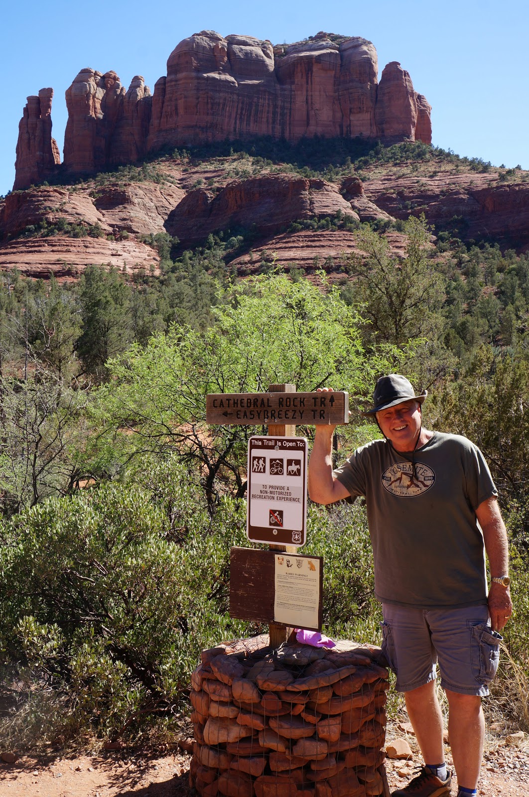
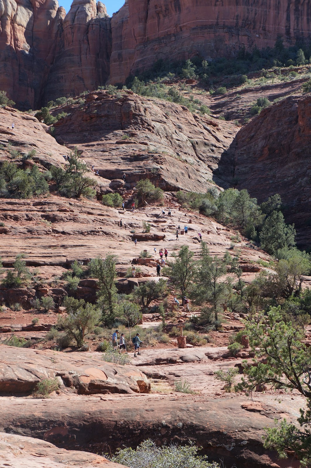
Happy tourists climbing Cathedral Rock. We saw lots of people in dress shoes, or carrying purses! Ummm oh-kayyy!
Templeton Trail cuts off from Cathedral Rock Trail in just 0.3 mile.
Lots of beautiful flora, but no fauna.

This is a great trail to do on a warm afternoon, when the trail is shaded and the payoff is the cool waters of Oak Creek! Just follow the green!
We honestly picked this trail because we were at 23.05 of our desired 25 miles, and just wanted a short trail to finish off the week. But it ended up being one of our favorites!
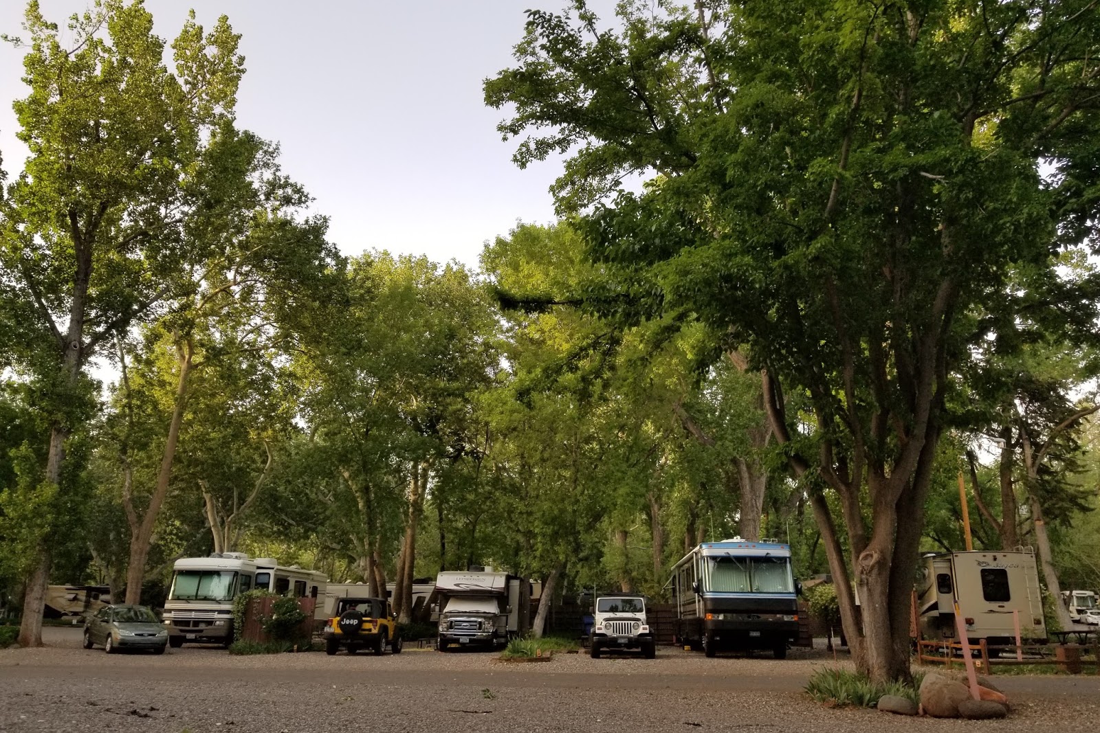
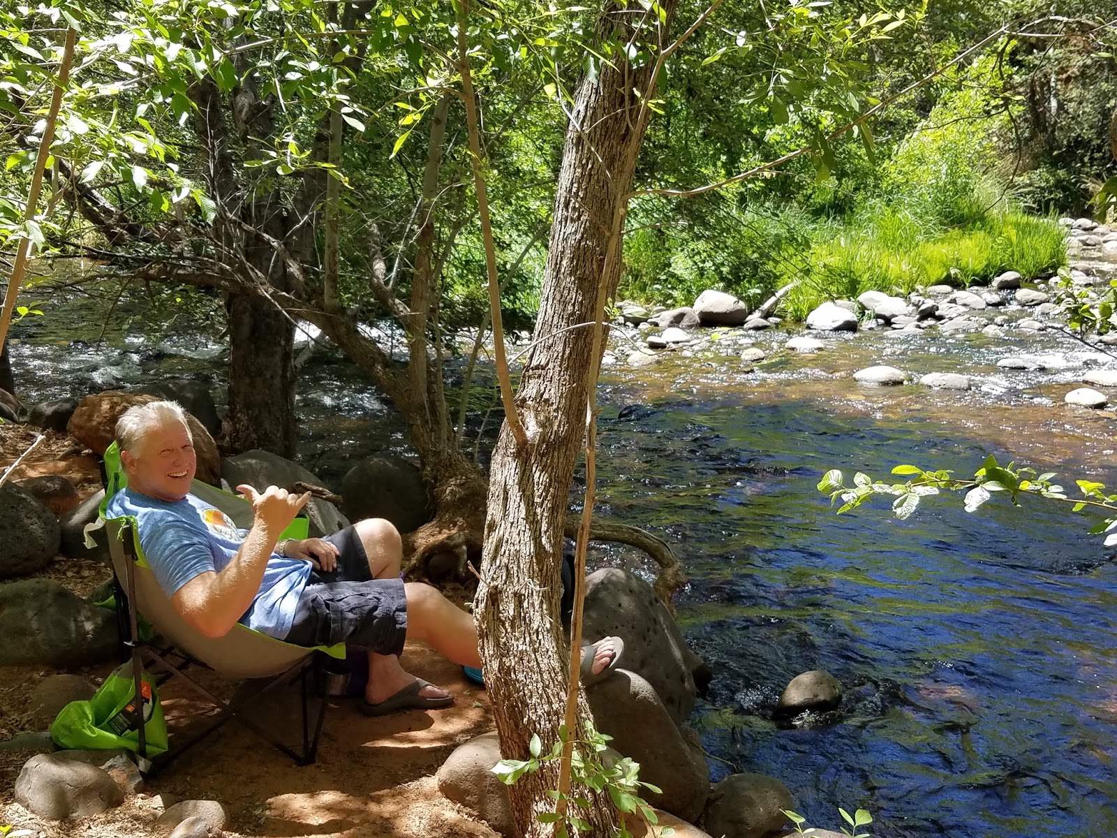
We camped at Rancho Sedona RV Campground, down in the canyon off Schnebly Hill Road, near Tlaquepaque and close to everything.
Loved their huge towering trees! They make the Lucky Charm look tiny!
The campground is right along Oak Creek! Why oh why did we hike to water, when we could literally walk just a few feet from our RV, you ask? Remember our goal! 25+ miles over 5 days!
And … we did it! 26.14 miles in 5 continuous days … even Sprinkles!
I firmly believe and desperately hope, however, that the calorie count is “off” on my pedometer.

We enjoyed the solitude of the trails, but not so much when we came off of them. Sedona roads and the city itself are a snarl of traffic pretty much 24/7!
All this hiking is good practice for this summer, when we’ll spend six weeks in two of our favorite outdoor places: Idaho and Wyoming! The Lucky Charm is ready to roll to cooler country again this summer. Until then, thanks for following along!


Leave a reply